 ENG
ENG  Español
 ENG
ENG CAT
CAT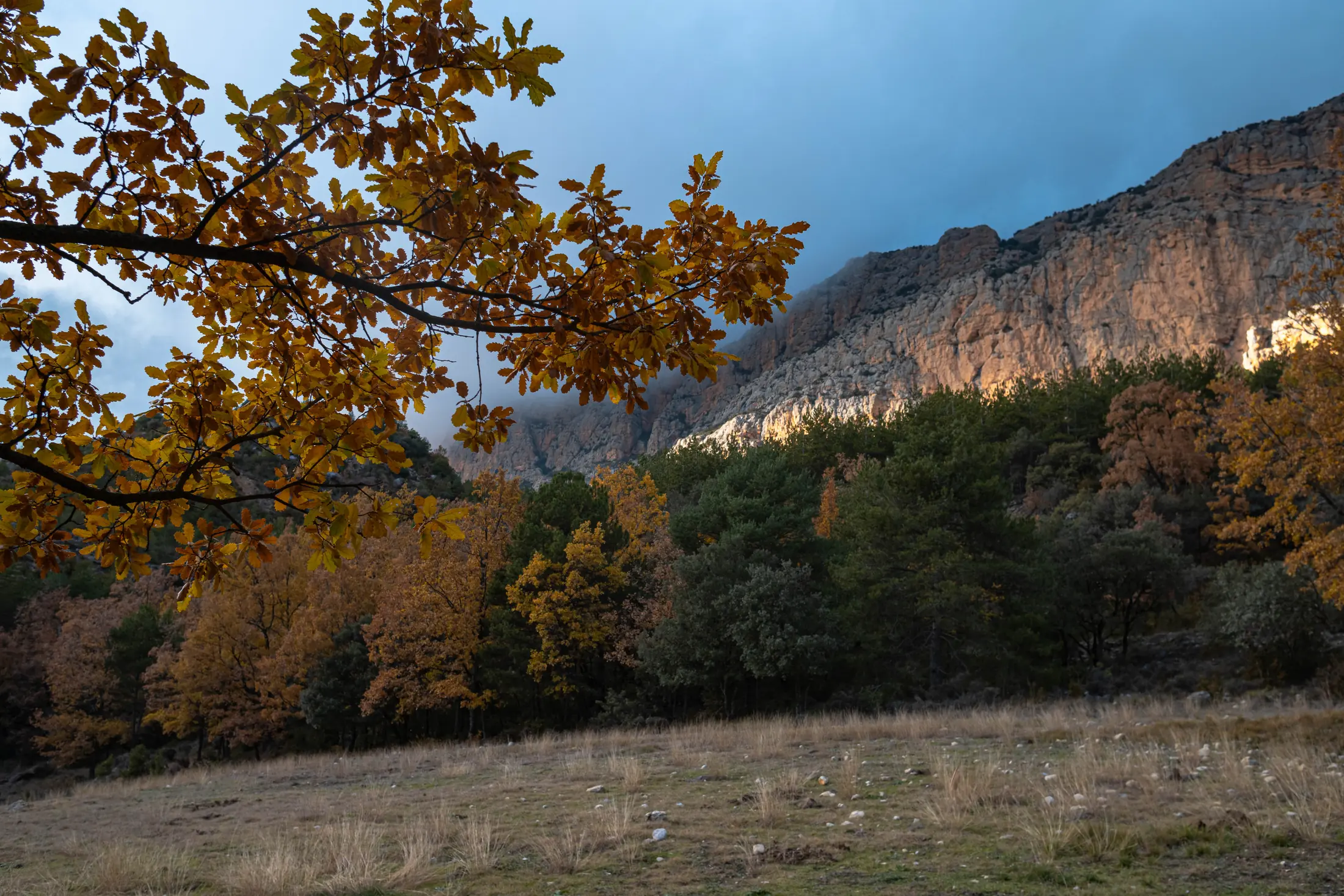 Forests, limestone cliffs and major changes in elevation create a landscape that transforms dramatically with the seasons and the light.
Boumort Reserve: Nature, Wildlife, Geology and Routes in the Lleida Pre-Pyrenees
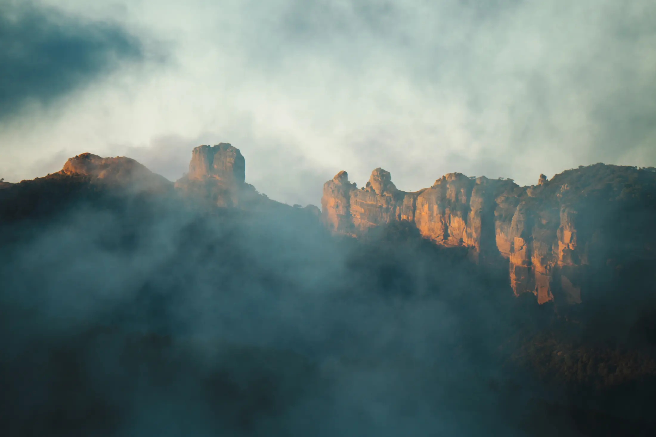
Some places can be understood from a viewpoint; others need time. Boumort belongs to the second group. To begin to understand this part of the Pre-Pyrenees, you need to travel along its tracks, enter its forests, walk beneath rock walls, stop when a silhouette crosses a hillside and look up when vultures begin circling above the ravines.The Boumort National Hunting Reserve covers a vast, sparsely populated area between Pallars Jussà, Pallars Sobirà and Alt Urgell.
Within just a few kilometres, the landscape changes from holm-oak woodland and dry slopes to pine forests, high-altitude meadows, deep ravines and summits rising above 2,000 metres. But reducing Boumort to its scenery would tell only half the story: beneath our feet lie ancient seabeds, its rocks preserve fossils of organisms that disappeared millions of years ago, and among the forests survive the traces of villages, hermitages and paths used for centuries.
Forests, limestone cliffs and major changes in elevation create a landscape that transforms dramatically with the seasons and the light.What is Boumort National Hunting Reserve?
Its official name is Reserva Nacional de Caça de Boumort (RNC de Boumort), or Boumort National Hunting Reserve. It was created in 1991 and covers 13,097 hectares of the western Catalan Pre-Pyrenees. The reserve extends across four municipalities in three counties: Conca de Dalt and Abella de la Conca in Pallars Jussà; Baix Pallars in Pallars Sobirà; and les Valls d’Aguilar in Alt Urgell.
Within its boundaries are several mountain ranges lying between the valleys of the Noguera Pallaresa and Segre rivers. The most representative are the Serra de Boumort, which gives the reserve its name, Serra de Carreu, Serra de Cuberes and Serra de Batsacans. Its highest point is Cap de Boumort, at 2,077 metres.
The term “National Hunting Reserve” may sound unusual to visitors coming here for nature and wildlife watching. However, the role of an RNC goes far beyond hunting. Boumort was created to conserve and manage wild animal populations and the ecosystems they depend on, while also regulating specific uses of the territory.
A large part of the reserve is public land and forms part of Catalonia’s protected natural-area network. This does not mean it is a developed park with paved roads, visitor centres every few kilometres or urban-style walking routes. Quite the opposite: one of Boumort’s defining features is its mountain character, its considerable distances and a network of forest tracks whose condition can change with the weather and the season.
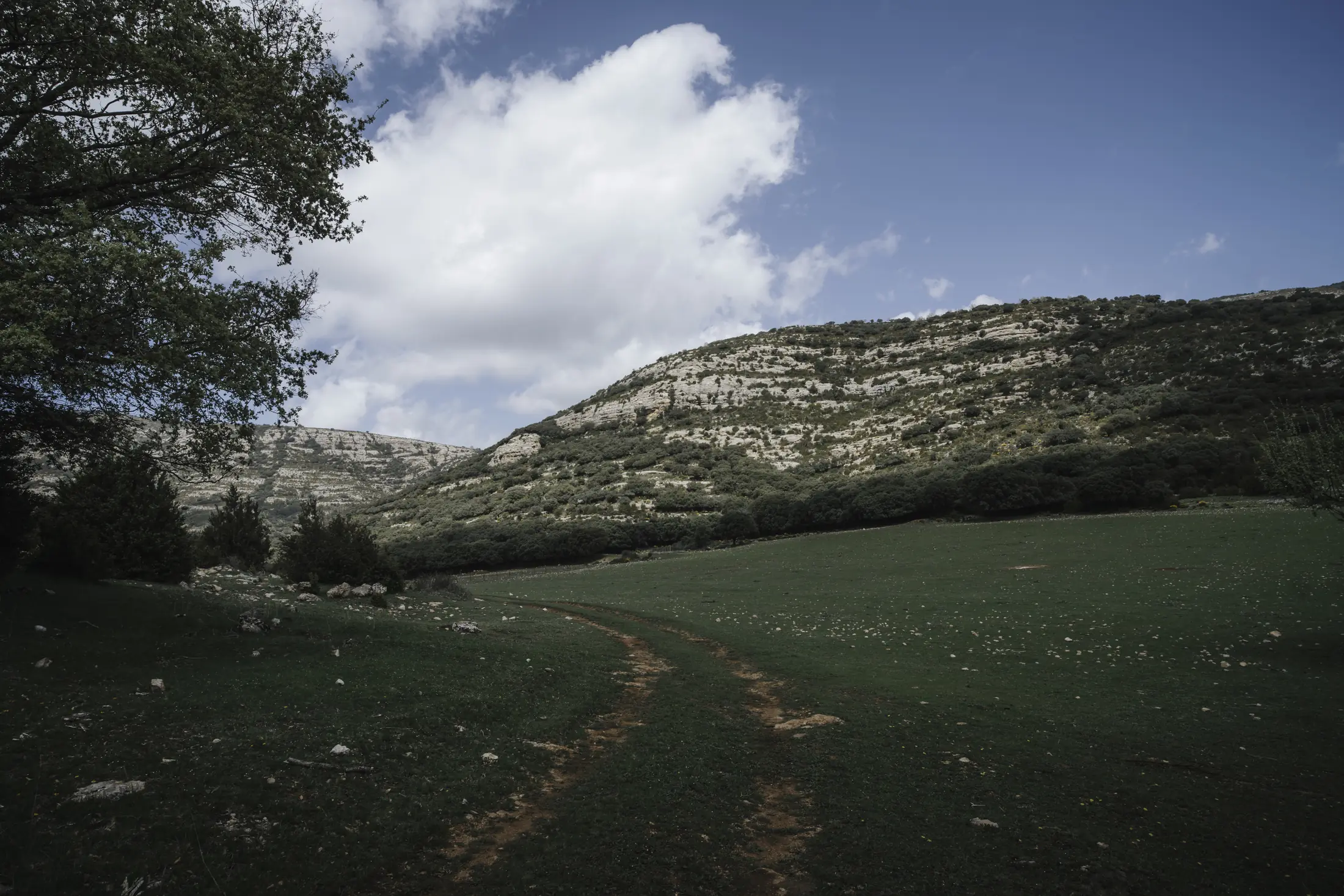
Boumort covers an extensive landscape of forests, pastures, ravines and limestone relief in the Pre-Pyrenees.
Where is Boumort and what is its landscape like?
Boumort lies in a transition zone. To the north, the environment gradually becomes more distinctly Pyrenean; to the south, the landscape has a clearly Pre-Pyrenean and Mediterranean character. This position, combined with major differences in altitude and slope orientation, explains much of its diversity.
Sunny slopes can be dry, rocky and covered with holm oak, juniper and scrub. Just a few kilometres away, a shaded slope may preserve dense pine forest. Higher up, black pine woodland appears, while the highest elevations are occupied by grasslands exposed to wind and snow.
The relief also makes it misleading to imagine the “Serra de Boumort” as one isolated mountain. The territory consists of a succession of ridges, plateaus, valleys, ravines and limestone walls. Orientation and elevation vary enormously from one area to another, and a forest track may need to travel many kilometres to connect two points that appear close together on a map.
This structure makes Boumort particularly well suited to varied itineraries. One day may be spent mainly on tracks and viewpoints; another on paths beneath immense cliffs; while another may begin in a forest and finish on a high point overlooking much of the Pallars mountain landscape.
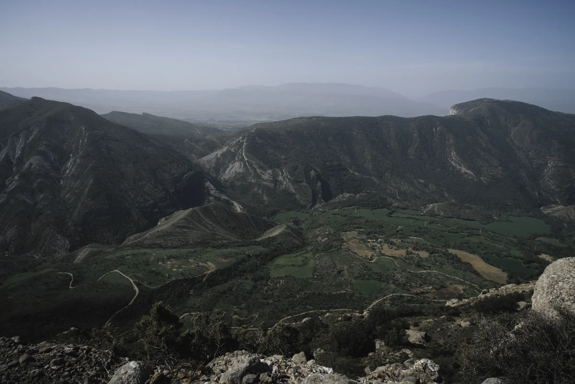
From the higher areas, the complexity of Boumort’s landscape becomes clear: ridges, ravines, inclined strata and small valleys.
Where does the name Boumort come from?
The origin of the place name has not been definitively established. Among the interpretations studied by linguist Joan Coromines is a possible relationship with old expressions that eventually gave rise to the form Bou Mort, literally “dead ox”.
The explanation has traditionally been connected with a territory where livestock farming, seasonal movement of herds and the use of mountain pastures played an important role for centuries. It should, however, be treated as an etymological hypothesis, rather than as a documented story about one particular ox.
What we do know is that Boumort’s landscape cannot be separated from its pastoral past. Many clearings, paths, barns, meadows and former settlements that we now perceive as part of the natural landscape are the result of centuries of human presence.
120 million years written in the rocks of Boumort
One of the best ways to look at Boumort is to imagine its mountains as an open book. Not because you need to understand geology to enjoy them, but because many of the forms visible during an excursion have surprisingly clear explanations.
Two major types of rock dominate the reserve and tell very different chapters of its history: marine limestone and marl, common in Carreu, Sant Corneli and Cap de Boumort itself, and conglomerates, formed from pebbles and sediment transported by ancient rivers and torrents.
When Boumort lay beneath the sea
More than one hundred million years ago, the landscape we see today did not exist. Part of this territory lay beneath the sea. Carbonates and other sediments accumulated on the seabed and eventually became the limestone and marl that now form many of the cliffs and slopes of Boumort and Carreu.
This is difficult to picture until a marine fossil appears inside a rock more than a thousand metres above sea level. At that point, the landscape suddenly takes on a different scale: in many places, walking through Boumort means walking over ancient seabeds that were raised during the formation of the Pyrenees.
Reefs that were not built by corals
Among the inhabitants of those seas were rudists, an extinct group of bivalve molluscs. Many looked very different from the shells we normally associate with bivalves: one valve could become cone-shaped and attach itself to the seabed, while the other acted rather like a lid.
Some species lived in groups and created substantial biological structures. During part of the Cretaceous, they were important reef builders, occupying an ecological role that today we mainly associate with corals. Some were small, while others reached surprisingly large sizes.
They disappeared at the end of the Cretaceous, around 66 million years ago, during the major extinction event in which non-avian dinosaurs also vanished.
When the Pyrenees began to rise
The landscape changed again as the dynamics between the Iberian and Eurasian plates began compressing materials that had accumulated over millions of years. Marine sediments were deformed, folded and eventually uplifted.
That is why many strata in Boumort are no longer horizontal. In areas such as Carreu, enormous rock layers are clearly tilted. They are not merely “lines” decorating the mountainside: they are ancient sedimentary beds that were raised and deformed during the formation of the Pyrenees.
When rivers buried the mountains
As the mountains rose, erosion was already wearing them away. Rivers and torrents tore away fragments of rock, transported them and deposited them in nearby basins.
Over millions of years, enormous thicknesses of coarse material accumulated. These deposits later became the conglomerates that now form distinctive features such as Roc de Pessonada and Roc de Santa.
In some areas, these deposits exceeded a kilometre in thickness. In other words, there were periods when large depressions and even parts of the relief were literally filled by material eroded from the young mountains.
Erosion revealed the mountains once again
The process did not end there. Water, ice, changes in temperature and gravity continued cutting into the terrain. Softer materials retreated more quickly, while harder rock remained standing out in relief. This is how ravines, cliffs, ridges and triangular forms developed — features that still allow us to follow the arrangement of the strata with the naked eye.
The limestone nature of many rocks also favoured the development of karst. Water penetrates cracks and slowly dissolves the rock, creating limestone pavements, cavities, springs, depressions and large rock shelters.
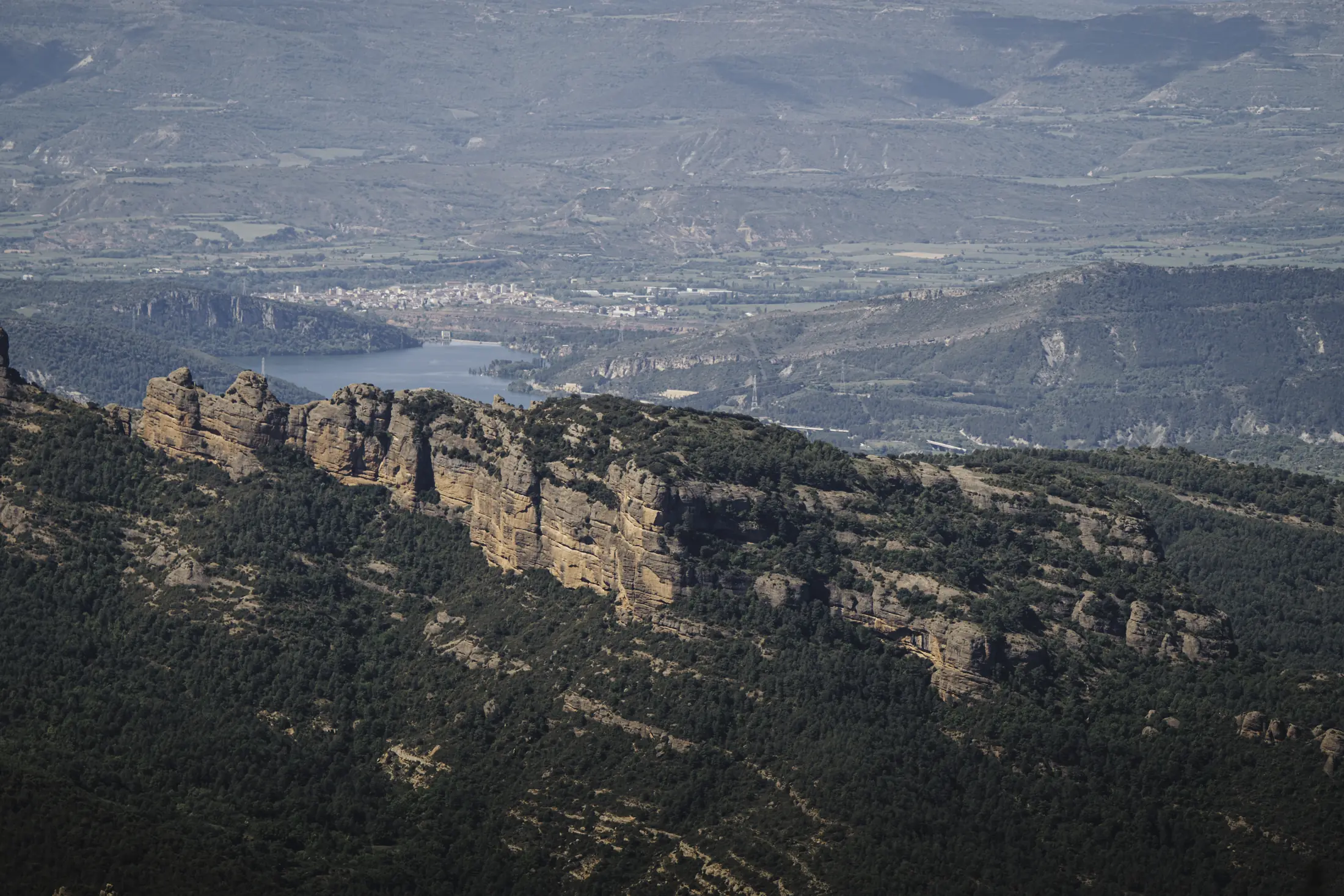
The present-day forms of Boumort are the result of millions of years of uplift, fracturing and erosion.
When geology determined where people could live
The relationship between geology and human life is especially clear at Espluga de Cuberes. Here, erosion and karst processes affecting the conglomerates created a large rock shelter. Much later, people used this natural protection to build a settlement beneath the cliff itself.
The result is one of the most unusual places in the Boumort area: a troglodyte settlement where walls, rooms and the hermitage of Santa Coloma can still be recognised.
Today it can be explored on our guided route to the abandoned village of Espluga de Cuberes, combining a 4×4 approach with hiking.
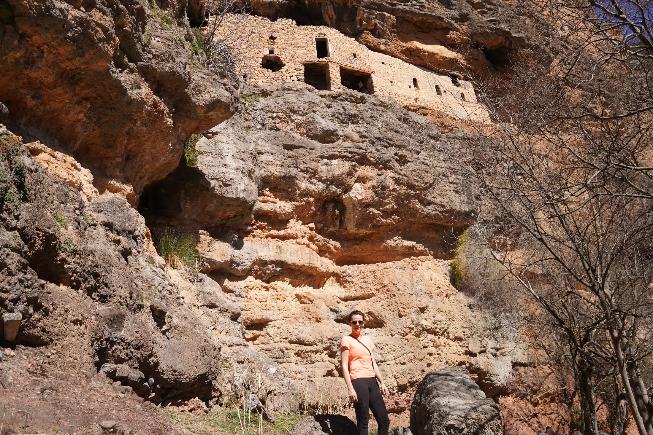
In places such as Espluga de Cuberes, geology itself provided shelter and directly influenced where and how people settled.
Fossils of Boumort: remains of ancient seas and vanished ecosystems
The rocks of Boumort preserve more than the shape of former landscapes. They also contain the remains of organisms that once lived in them.
The Upper Cretaceous limestone and marl of the Carreu and Boumort ranges contain ammonites, inoceramids, brachiopods, oysters, sponges, corals, rudists and echinoids. Together, these fossils help reconstruct different environments of the ancient sea.
Micraster: heart-shaped sea urchins
One of the most recognisable fossils is Micraster, an extinct genus of sea urchin. Its fossilised tests have a characteristic shape reminiscent of a heart.
These animals lived buried in sediment on the seabed, which favoured their fossilisation. Today they are also a good example of why geological conservation matters: in certain areas they are increasingly difficult to find because specimens were removed for many years.
Roc de Santa: when Boumort also had lakes
The story does not end with the ancient sea. Around Roc de Santa lies an important Eocene mammal site preserved in rocks formed in former lake environments.
Around 37 million years ago, the territory we now associate with Boumort was inhabited by turtles, lizards, rodents, marsupials, primitive carnivores and early relatives of horses. The palaeontological record also includes remains belonging to several genera of small primates.
It is the kind of information that changes the way we see the landscape: Boumort was once a sea, later became part of a rising mountain chain and, at other moments in its history, also contained lake environments.
The human footprint in Boumort
Looking across large expanses of forest and rock, it is easy to imagine Boumort as a place that was always empty. It was not.
For centuries, these mountains were used for livestock farming, grazing, timber, small-scale cultivation and other mountain resources. Paths we now follow for hiking once connected houses, barns, hermitages and small inhabited settlements.
The gradual depopulation of the rural mountains left many of these places empty. Their ruins remain scattered throughout the landscape and are now an inseparable part of the Boumort experience.
Cuberes, Espluga de Cuberes, Solduga and Herba Savina are some of the names that help reconstruct this human geography. Elsewhere there are hermitages, dry-stone walls, abandoned fields and the remains of buildings that can be difficult to recognise unless you know what to look for.
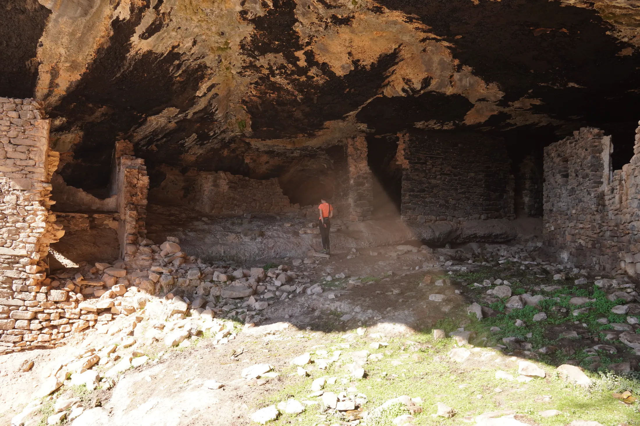
Walls, houses and former inhabited spaces remind us that for centuries Boumort was also a place of everyday life and work.
Espluga de Cuberes shows this relationship between nature and human occupation particularly well. The houses occupy a huge rock cavity; from inside, the view opens towards ravines and mountains — the same landscape once seen by its inhabitants.
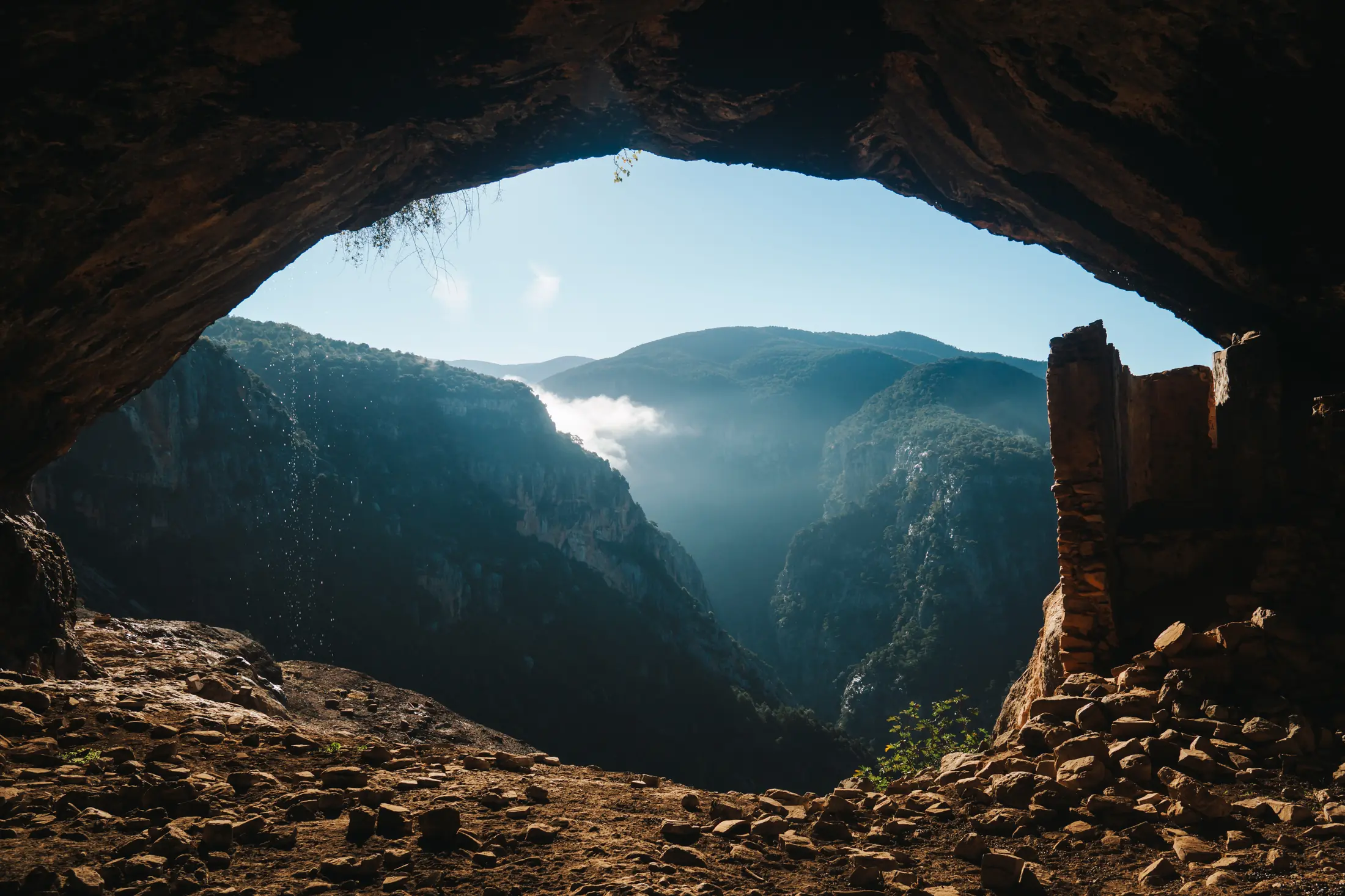
Looking out from an inhabited rock shelter helps us understand how closely rock, refuge and human life were connected.
Herba Savina: another side of Boumort told through its inhabitants
An excursion through Boumort can also be combined with a visit to Herba Savina, an abandoned village in Pallars Jussà located between Carreu and Boumort. Its isolation, ruins and the stories of the people who lived there reveal a very different side of these mountains.
If you would first like to discover its history, read our article about Herba Savina and its abandoned village.
If you would rather explore it on the ground, see our guided route to Herba Savina, which can be combined with other areas of Boumort.
Flora of Boumort: from Mediterranean vegetation to subalpine landscapes
Boumort’s botanical diversity is explained by its broad range of elevations and the strong contrast between sunny and shaded slopes. Within a relatively compact area, almost all the vegetation belts typical of this part of the Pre-Pyrenees are represented, with the exception of the true alpine belt.
Holm oak and Mediterranean scrub at lower elevations
The lower areas and sunniest slopes have a distinctly Mediterranean character. Holm-oak woodland and scrub adapted to dry conditions dominate, including rosemary and various thorny plants.
Pine forests and oak woodland
At middle elevations, many areas are dominated by black pine (Pinus nigra) and Scots pine. Oak woodland is now more restricted to ravines, shaded slopes and less accessible areas, although historically its potential distribution was much greater.
The forests are not uniform. A single route may pass through dense pine woodland, small clearings, former fields and rocky slopes where exposed stone once again becomes dominant.
Mountain pine and high-altitude grasslands
At higher elevations, mountain pine appears, and above approximately 1,800 metres the forests gradually give way to mountain grasslands and rocky terrain.
The reserve also contains strictly protected plants such as Aquilegia pyrenaica, Narcissus alpestris, Astragalus danicus, Thymelaea nivalis and Pulsatilla alpina.
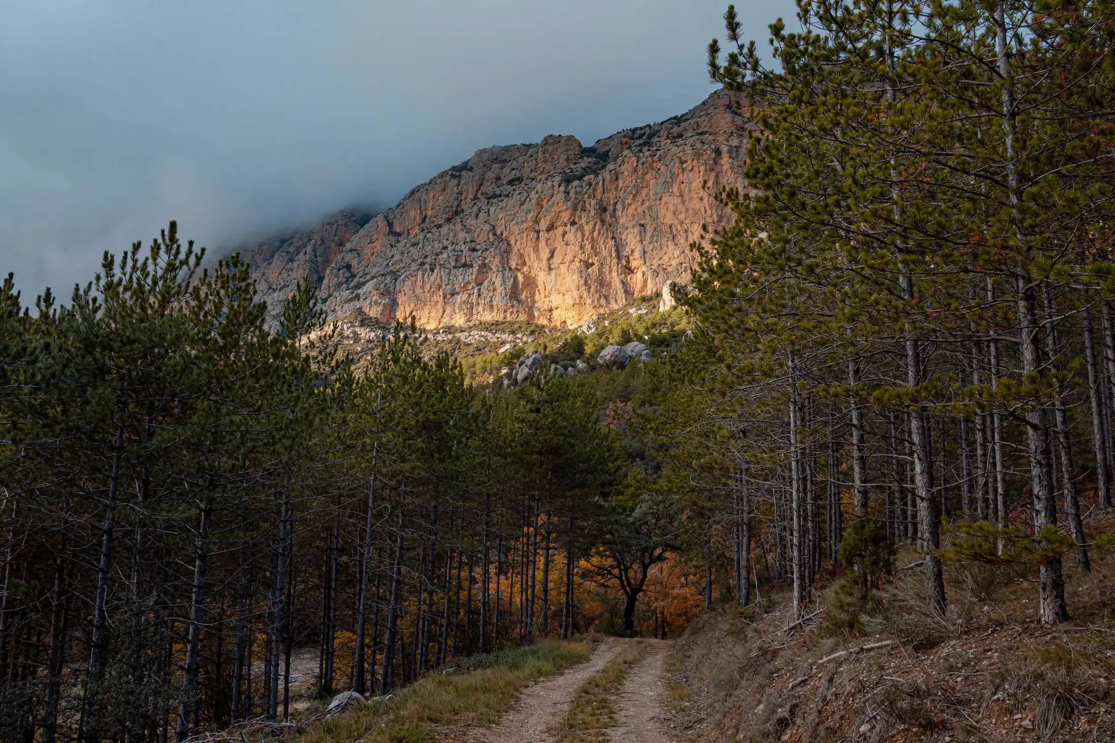
Vegetation can change quickly with altitude, slope orientation and the availability of water.
Wildlife of Boumort: much more than red deer
Red deer are the species most readily associated with Boumort, but the reserve’s wildlife is far more diverse.
Red deer, Pyrenean chamois and roe deer
The reserve supports one of the most important and well-structured populations of red deer in the Pyrenees. Outside the rutting season they can be found in different areas, although it is worth remembering one essential point: these are wild animals and sightings can never be guaranteed.
The Pyrenean chamois, or isard, also lives here, particularly in mountain terrain, while roe deer have a more localised distribution. Wild boar are common in forest environments and frequently move through holm-oak and oak woodland in search of food.
More elusive mammals include foxes, badgers, stone martens, pine martens, weasels and wildcats. In many cases, visitors are more likely to find their tracks and signs than to see the animals themselves.
Boumort and the great vultures
Rock walls and rising air currents make Boumort an exceptional place for observing large birds. The reserve is home to bearded vultures, griffon vultures, Egyptian vultures and cinereous vultures.
The case of the cinereous vulture is particularly interesting. The species had disappeared as a breeding bird from Catalonia, and a reintroduction project began in Boumort in 2007. The establishment of a breeding population turned the reserve into a remarkable place: all four European vulture species breed here.
The reserve also has a dedicated hide for observing scavenging birds, although prior authorisation is required to use it.
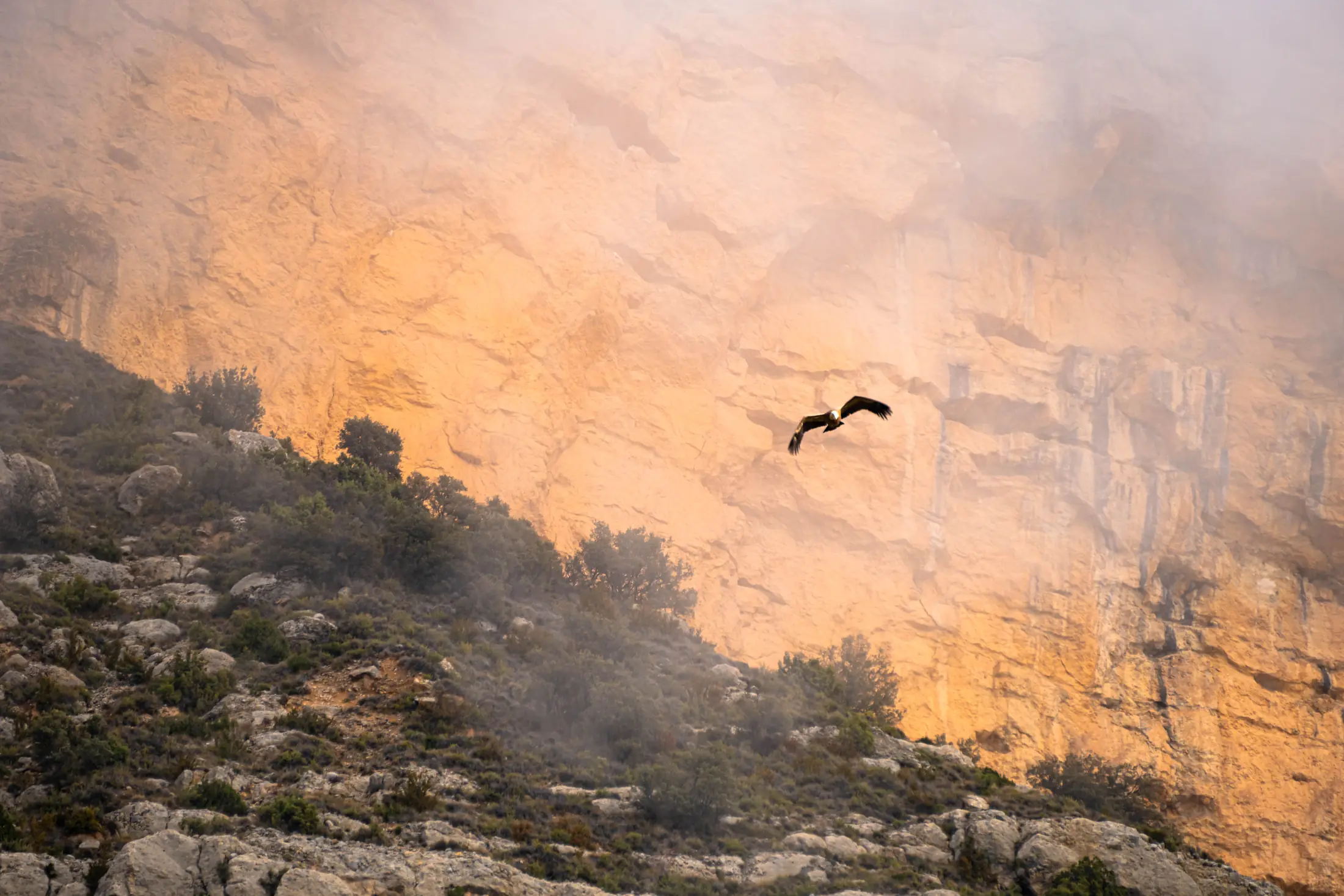
The immense cliffs and thermal air currents make Boumort particularly favourable for large birds of prey and scavengers.
Watching them does not mean approaching them. Binoculars, a spotting scope or a telephoto lens allow us to observe their flight and behaviour without disturbing their natural activity.
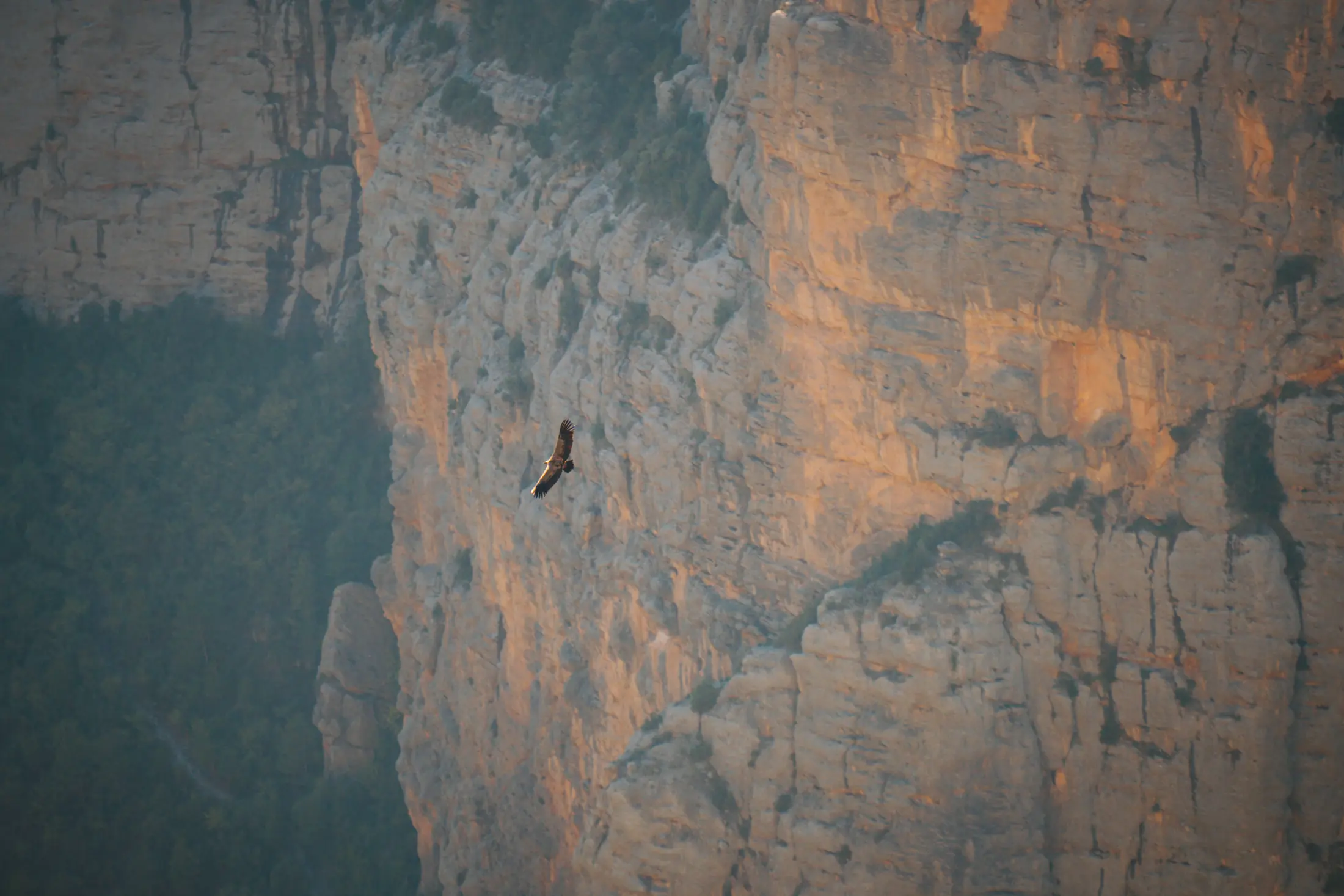
Wildlife watching in Boumort usually means looking from a distance: binoculars and spotting scopes make it possible to enjoy natural behaviour without approaching the animals.
The red deer rut in Boumort
At the end of summer and beginning of autumn, one of the best-known events in Boumort’s natural calendar begins: the red deer rut.
During the mating season, males produce powerful roars to announce their presence and compete for access to groups of females. At certain times there may also be chases, displays and fights between rival males.
The most active period generally falls between mid-September and mid-October, although the precise dates vary from year to year depending on environmental conditions.
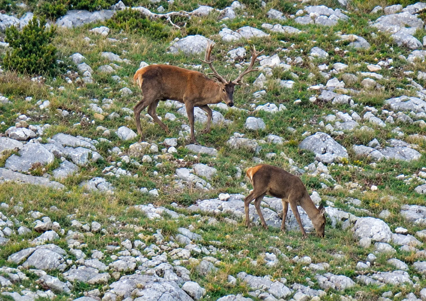
The rut makes autumn one of the most interesting times to observe red deer behaviour in Boumort, always from a respectful distance and without disturbing the animals.
The hours around dawn and dusk often coincide with increased mammal activity. That does not mean we should move closer. A rutting stag can be dangerous, and unnecessary disturbance occurs at an especially important moment in the animals’ reproductive cycle.
Special visitor-management measures are introduced during the rut. Permitted areas, recommended paths and other restrictions may vary from one season to another, so current information should always be checked before entering the reserve.
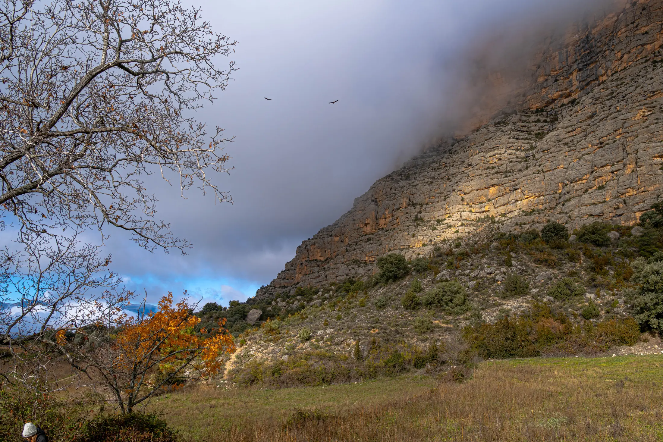
The rut coincides with one of the periods of greatest change in Boumort: cooler temperatures, autumn colours and increased red deer activity.
Would you like to hear the red deer rut in Boumort?
At MundoCanyon we organise guided outings to watch and listen to the red deer rut, using 4×4 vehicles, binoculars and a spotting scope, and adapting each trip to the conditions and restrictions in force that season.
Places that help you understand Boumort
There is no fixed checklist of “must-see monuments” in Boumort. Part of its appeal lies precisely in connecting different places and understanding what each one tells us about the territory.
Cap de Boumort
At 2,077 metres, this is the highest point in the reserve. From the upper areas, the succession of Pre-Pyrenean ranges and the contrast between forest, grassland, cliffs and ravines can be appreciated particularly well.
Carreu Valley
This is one of the most interesting areas for understanding Boumort’s geology. The slopes clearly reveal inclined marine strata, while nearby landforms are built from younger conglomerates.
Bosc de Pentina
A predominantly forested area, interesting for its vegetation as well as its geological and wildlife context. Around Pentina, much older geological materials also appear alongside the major Cretaceous formations that dominate other parts of the reserve.
Cuberes and Espluga de Cuberes
Nature and human history meet at Cuberes. Espluga de Cuberes is one of the clearest examples: buildings constructed inside large natural cavities and a path overlooking the Collegats and Boumort landscapes.
Barranc de l’Infern
This deep ravine reveals some of the geological contrasts found in the Collegats area. It also forms part of one of the most rugged landscapes in the transition between Pallars Jussà and Pallars Sobirà.
Coll de Llívia
One of the natural mountain passes in the area and a good point from which to appreciate the Carreu Valley and the eastern parts of the reserve. It also provides access to several itineraries.
Roc de Pessonada
Its reddish and orange conglomerates contrast with the grey marine rocks of Carreu. It is particularly interesting because two very different chapters in the geological history of these mountains can be compared with the naked eye.
Roc de Santa
Besides its panoramic views, Roc de Santa preserves the palaeontological record of an ancient Eocene lake environment and the remains of mammals that lived here approximately 37 million years ago.
L’Argenteria and Congost de Collegats
Immediately around Boumort, the Congost de Collegats shows how the Noguera Pallaresa has cut through the limestone. L’Argenteria is especially notable for its calcareous tufa deposits, formed when calcium carbonate dissolved in water precipitates again on the rock face.
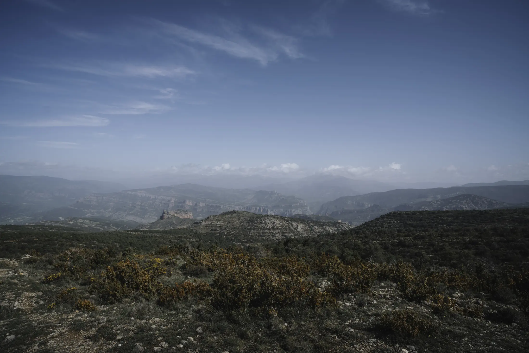
From the higher areas of Boumort, the landscape opens onto a succession of ranges, ravines and basins across the Pallars.
How to explore Boumort
The size of the reserve means there is no single correct way to visit it. Some routes make most sense on foot, others benefit from a 4×4 for long approaches, and on many days combining both methods is particularly practical.
Trekking: discovering Boumort at a different pace
Walking gives you time to notice details that can easily be missed from a vehicle: a fossil in a rock, animal tracks, changes in vegetation, old walls or the structure of the rock layers.
It also opens access to areas beyond the tracks and allows the mountain itself to become the focus of the day, with distance and elevation gain adapted to the group’s fitness.
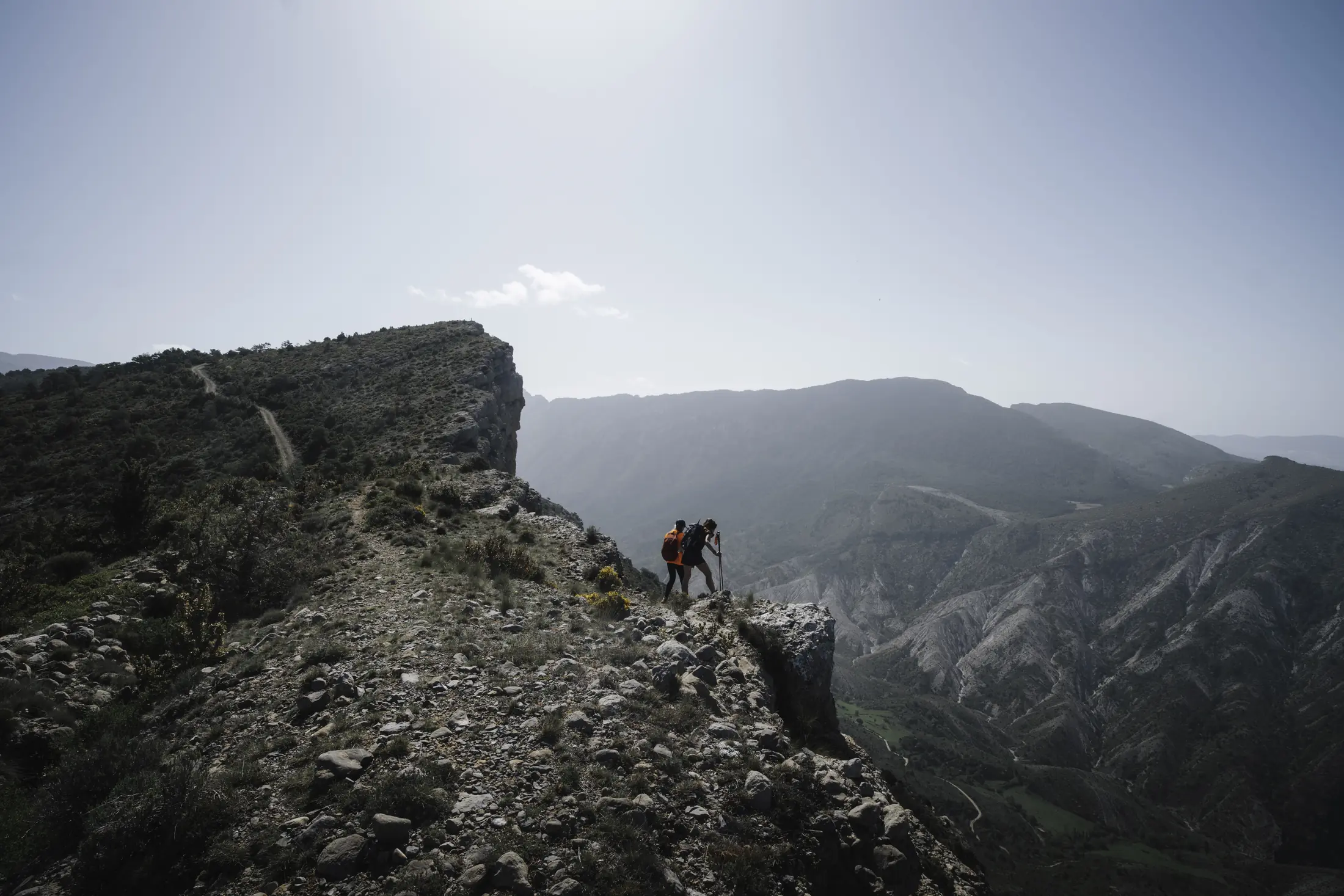
Walking reveals a scale and level of detail in the landscape that can easily go unnoticed from the forest tracks.
At MundoCanyon we organise hiking and trekking routes in the Pyrenees and Pre-Pyrenees, adapting each itinerary to the level of the group and the conditions on the ground.
Exploring Boumort by 4×4
Distances within the reserve are considerable and many tracks cross isolated areas. A 4×4 makes it possible to move between very different sectors in a single day and is particularly useful for wildlife watching, photography or routes where the main goal is not to cover a large distance on foot.
Not all tracks are in the same condition. Rain, mud, ice, snow, rockfall and forestry work can change access conditions, and some itineraries are not suitable for conventional cars.
Organised vehicle routes within the reserve are also regulated, so it is important to respect the rules and use companies with the necessary authorisations.
4×4 + trekking: travel farther, then continue on foot
In many cases there is no need to choose between driving and hiking. A mixed format allows a 4×4 to cover a long approach so the walking section can begin directly in the area of interest.
A day can therefore be centred on geology, wildlife or heritage, entering along a track and then spending several hours exploring on foot.
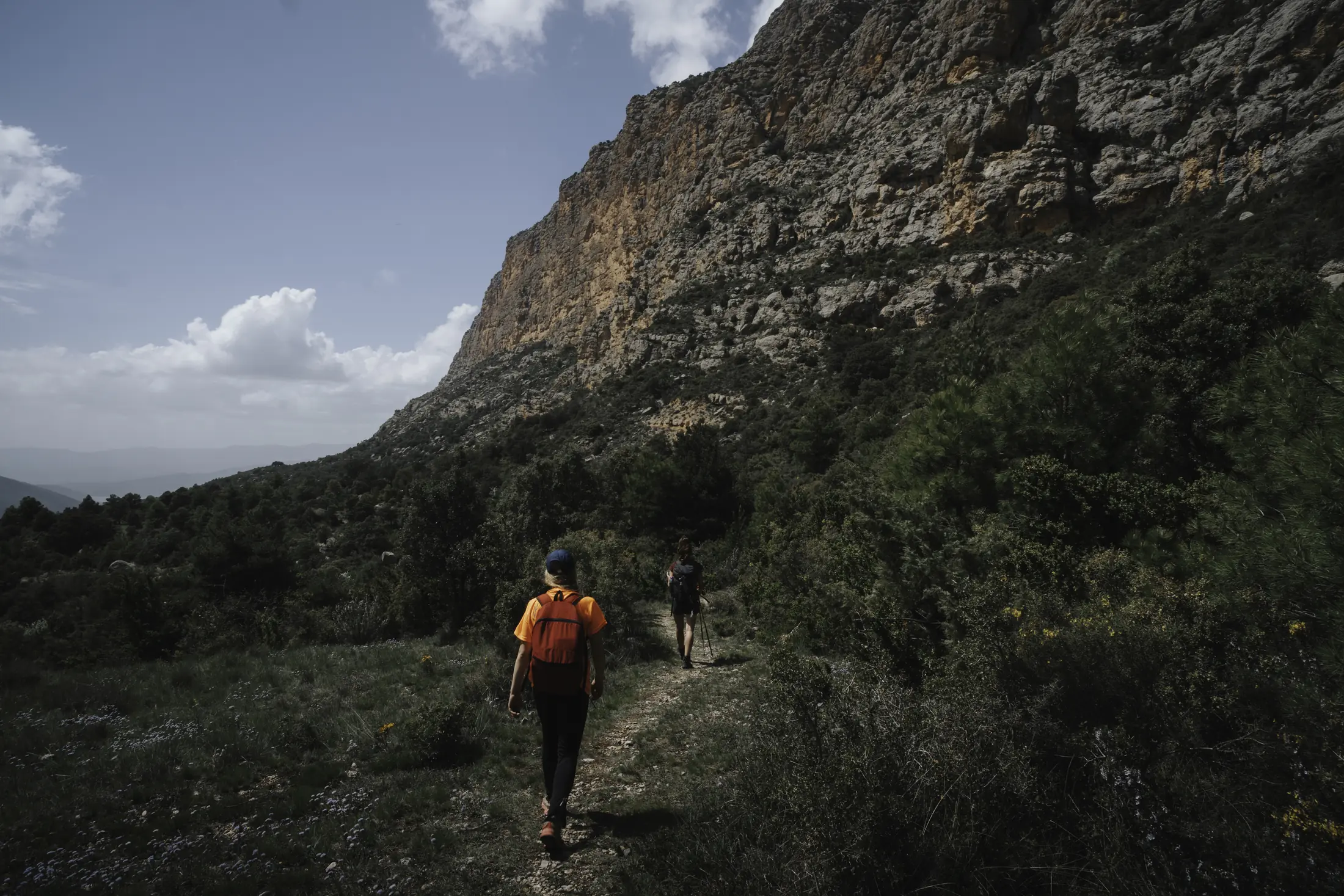
Combining 4×4 travel with walking sections makes it possible to adapt the day to the terrain, season and interests of the group.
What kind of Boumort route suits you?
We can organise the day mainly on foot, by 4×4 or by combining both options. The itinerary is adapted to the season, the state of the tracks, the time available and the group’s fitness level.
Some routes for discovering Boumort
The network of tracks and paths allows many different combinations. These are just a few examples of what is possible; access, weather and terrain conditions should always be checked before setting out.
Refugi de Boumort – Cap de Boumort
A relatively short option from the refuge area to the highest point in the reserve. It is particularly interesting for its high-altitude scenery and panoramic views over the Pre-Pyrenean ranges.
Coll de Llívia – Cap de Boumort
A longer alternative for those who want to turn the ascent into a full mountain day. It crosses several different environments and gives a better sense of the scale of the massif.
Salt de la Núvia – Espluga de Cuberes – Solduga
One of the richest itineraries for reading the landscape: conglomerates, huge cliffs, cavities, abandoned settlements and sections overlooking the Collegats area.
If your main objective is to visit the settlement, see our excursion to Espluga de Cuberes.
Carreu Valley
Rather than being a single route, Carreu allows several different itineraries and approaches. It is an especially interesting sector for anyone who wants to understand the geology, walk beneath large cliffs and cross open mountain landscapes.
Pessonada – Herba Savina
The old path to Herba Savina connects the landscapes of Pessonada and Carreu with one of the most unusual abandoned villages in Pallars Jussà. It can be done as a trekking route or incorporated into a longer day with a 4×4 approach.
To learn more about the history of the place, read our article Herba Savina: the story of an abandoned village.
See the guided route to Herba Savina →
What is the best time to visit Boumort?
There is no single answer. Part of Boumort’s appeal is precisely that every season reveals a different territory.
Spring: walking through a reserve coming back to life
Spring is an excellent season for hiking. Temperatures are generally more comfortable than in midsummer, daylight hours increase and vegetation enters one of its most active periods.
It is also a good season for wildlife watching, although conditions at higher elevations may still be wintry early in the season.
Summer: long routes and high elevations
Long daylight hours make extended itineraries easier and allow more time to explore the higher parts of the reserve. However, temperatures can become intense at lower elevations and on exposed slopes.
It is advisable to start early, carry more water than you think you will need and not underestimate the lack of shade on many routes.
Autumn: red deer rut, forests and changing light
Autumn is perhaps the season that transforms Boumort most dramatically in a short period of time. The red deer rut coincides with changing colours in deciduous woodland, generally comfortable hiking temperatures and especially interesting light for photography.
It is also a sensitive period for wildlife. During the rut, designated routes and restrictions established for each season must be strictly respected.
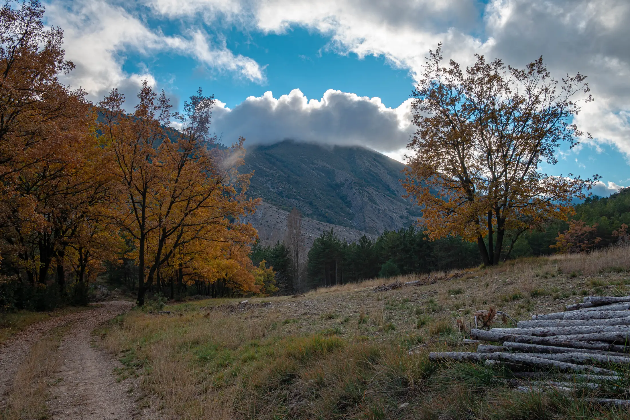
Autumn transforms Boumort’s forests and also coincides with one of the most interesting periods for observing red deer behaviour.
Winter: Boumort at its quietest
Snow changes the reserve completely. Some tracks may close or become impassable, while forests and higher areas take on a much more austere appearance.
When conditions allow, some areas can be explored with snowshoes. MundoCanyon also organises snowshoeing excursions in the Lleida Pyrenees, although any route in Boumort must always be adapted to the depth and condition of the snow.
Rules and responsible visiting in Boumort
Boumort is a wildlife reserve, not an unrestricted recreational area. Rules may change temporarily for conservation and management reasons, fire risk, snow or forestry work, so current conditions should be checked before every visit.
- Drive only on roads and tracks open to public access and respect all signs.
- During the red deer rut, remain on authorised or recommended tracks and paths.
- Wild camping is prohibited inside the reserve.
- Sleeping overnight in vehicles or motorhomes inside the reserve is also prohibited.
- Do not light fires.
- Visitors’ dogs must be kept on a lead. For wildlife-watching outings, it is generally better not to bring them.
- Do not use spotlights, calls or devices that alter animal behaviour.
- The use of camera traps is regulated and is not freely permitted.
- Do not feed wildlife.
- Drive slowly: an animal crossing the track may be followed by others.
- Respect private property, cultivated land and meadows. Not every open-looking area is freely accessible.
- Take all waste away with you, including organic waste.
Distance is part of wildlife watching too
The animals of Boumort are not accustomed to being approached for photographs. Use binoculars, a spotting scope or a telephoto lens. If an animal changes direction, moves away or alters its behaviour because of your presence, you are too close.
During the rut, an especially cautious distance should be maintained from male deer. Apart from the stress caused to the animal, a rutting stag can react dangerously.
Fossils are not souvenirs
Palaeontological heritage is protected. Finding a fossil during a route does not mean that it may be removed and taken home.
A fossil has scientific value precisely because of its position, the rock containing it and its relationship with the surrounding geology. Removing it destroys part of that information and turns something that could be observed by thousands of people into a private object.
The case of Micraster is particularly illustrative: geological interpretation material for Boumort notes that these fossils have become increasingly difficult to observe in certain areas because of collecting and removal in the past.
Observing is part of the experience; taking a piece of the landscape away is not.
What to bring when visiting Boumort
Equipment depends on the activity and the season, but several items are worth carrying even on relatively straightforward routes:
- mountain footwear with good grip;
- layered clothing;
- a windproof or waterproof outer layer;
- enough water;
- sun protection, hat and sunglasses;
- some food;
- a map or offline navigation;
- a fully charged phone and, for longer routes, a power bank;
- binoculars if you are interested in wildlife;
- a headtorch if the outing starts before dawn or may finish late.
Do not rely exclusively on your phone. Mobile coverage can be limited or completely unavailable in interior areas.
For wildlife photography, a telephoto lens is far better than trying to physically reduce the distance between yourself and the animal.
Visiting Boumort independently or with a guide?
The reserve can be visited independently using tracks and paths open to public access. For people accustomed to mountain environments, experienced in navigation and with a route planned in advance, organising an independent day is entirely possible.
A local guide provides a different kind of value. It is not simply a matter of showing the way.
A guide can adapt the route to the actual condition of the tracks, the weather and the season; interpret animal tracks and behaviour; explain why a rock, cliff or old building is located where it is; and avoid spending a large part of the day on approaches that do not match the aim of the excursion.
For activities such as the red deer rut or observing large birds of prey, knowledge of the most appropriate times, areas and viewing distances can be particularly useful.
MundoCanyon is based in La Pobla de Segur and organises mountain and nature activities throughout the Pallars and other areas of the Pyrenees and Pre-Pyrenees. You can also explore our adventure activities and routes in the Pyrenees.
Boumort has more than one face
You can travel through Boumort several times and return with completely different memories.
One day may be defined by two vultures circling above a cliff. Another by the sound of a deer that you still cannot see. On another outing, the most memorable moment may be finding a marine fossil in a rock or stepping beneath a huge shelter and imagining the families who once lived there.
Fog may hide a mountain that appears fully illuminated just a few hours later; a summer forest barely resembles the same place in October; and an easy track in September may become inaccessible after snowfall.
Perhaps that is why Boumort does not work particularly well as a checklist of places to “tick off”. It makes more sense when understood as a territory: geology, wildlife, forests, villages, paths and millions of years of history layered within the same landscape.
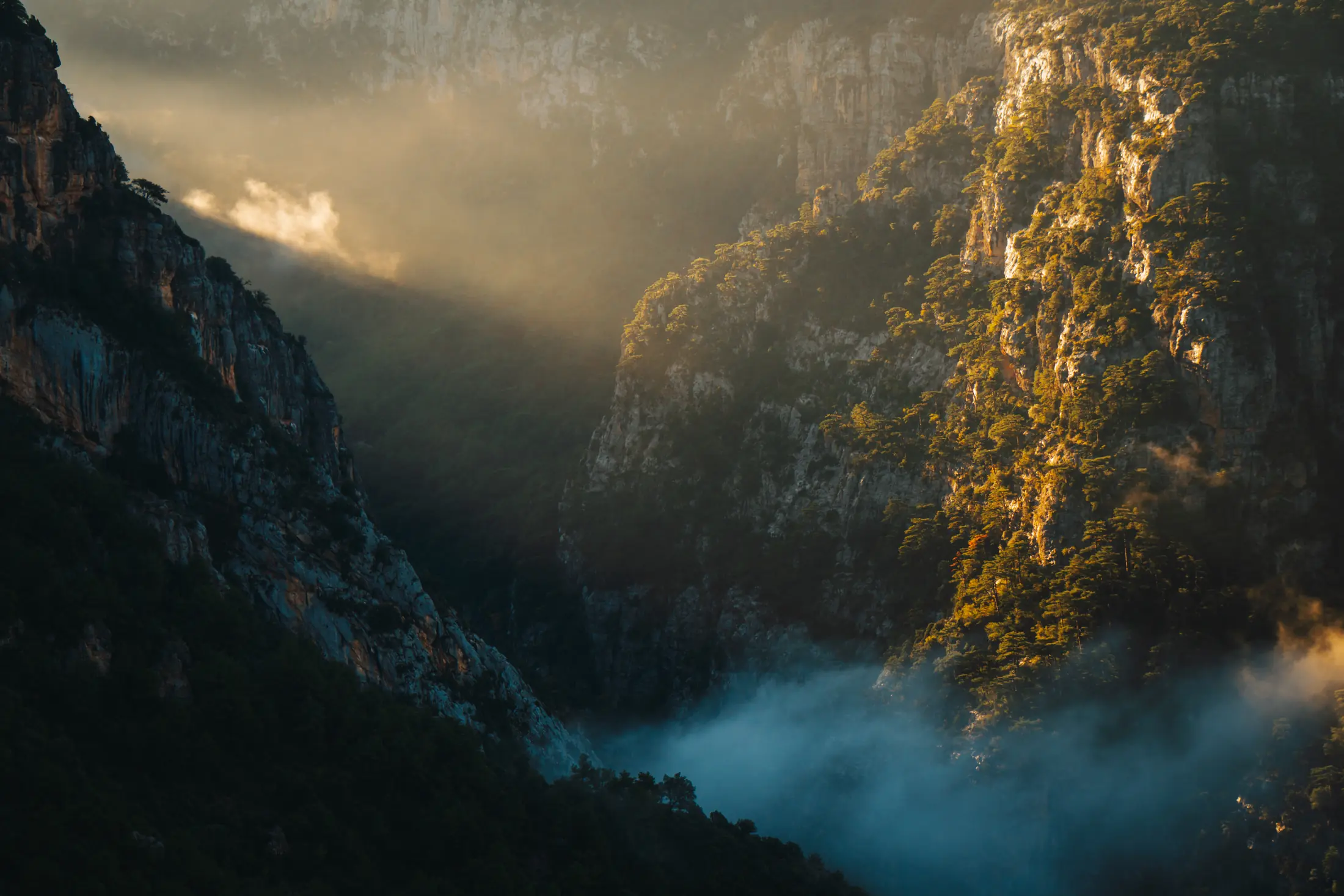
No two days in Boumort are the same: light, clouds, wildlife and the seasons continually change the way the territory is perceived.
Discover Boumort with MundoCanyon
There is no single way to discover Boumort. We can dedicate the day to trekking, explore different areas by 4×4, or combine driving and hiking to make better use of the distances involved.
In autumn, the focus may be the red deer rut; at other times of year it might be geology, wildlife watching, an ascent of Cap de Boumort or a visit to former settlements such as Espluga de Cuberes and Herba Savina.
We adapt each outing to the season, terrain conditions, the state of the tracks, the fitness level and interests of the group.
Frequently asked questions about Boumort National Reserve
Where is Boumort National Reserve?
Boumort National Hunting Reserve is located in the western Catalan Pre-Pyrenees, between the valleys of the Noguera Pallaresa and Segre rivers. Its territory is divided between the counties of Pallars Jussà, Pallars Sobirà and Alt Urgell.
Can you visit Boumort independently?
Yes. Visitors may use the network of tracks and paths open to public access, provided they respect signs and current restrictions. Certain activities, organised routes and access points may be regulated, particularly during sensitive periods such as the red deer rut.
What is the best time to visit Boumort?
It depends on what you want to do. Spring is excellent for hiking and nature; summer offers long days and easier access to higher elevations; autumn combines the red deer rut, forest colours and comfortable temperatures; and in winter, when there is sufficient snow, some areas can be explored on snowshoes.
When is the red deer rut in Boumort?
It generally takes place between mid-September and mid-October, although the precise period depends on conditions in a given year. Specific rules are introduced during these weeks to reduce disturbance to the animals.
Can you drive through Boumort in a normal car?
Some access roads may be suitable for conventional vehicles, but a significant part of the internal network consists of forest tracks. Their condition changes with rain, snow and maintenance work. A 4×4 and experience driving on unpaved mountain tracks are recommended for certain routes.
What animals can you see in Boumort?
The best-known species include red deer, Pyrenean chamois, roe deer and wild boar. Numerous carnivores and forest birds also live here. Bearded vultures, griffon vultures, Egyptian vultures and cinereous vultures can be observed around the reserve’s cliffs and skies, together with other birds of prey.
Which abandoned villages can you visit in Boumort?
One of the most unusual places is Espluga de Cuberes, a troglodyte settlement built beneath large rock shelters. You can also visit Herba Savina, a former mountain settlement in the Carreu and Boumort area. To learn about its history before doing the route, read our article about the abandoned village of Herba Savina.