 ENG
 Español
 ENG
 CAT

Vall Fosca: what to see, villages, routes and activities in the Lleida Pyrenees
In brief:
- Where it is: Vall Fosca lies in the north of Pallars Jussà, in the Lleida Pyrenees, following the course of the Flamisell River.
- What makes it special: small mountain villages, Romanesque and hydroelectric heritage, canyons, forests and an impressive high-mountain lake district.
- Must-sees: Estany Gento, the Sallente cable car, the Carrilet greenway, Capdella, Estavill, Espui and the Capdella Hydroelectric Museum.
- Hiking: there are more than 100 km of paths, ranging from routes between villages to high-mountain itineraries around Estany Gento, Colomina, Port de Rus and Filià.
- In winter: Filià, Riqüerna, Colomina and other high areas offer interesting options for snowshoeing, always depending on snowpack conditions.
- Adventure: Vall Fosca has numerous canyons and can be combined with via ferratas, caving and orienteering activities.
- Events: La Cabanera is one of the valley’s main trail-running events, while the Vall Fosca Hiking Festival and the Fira Ramadera in La Pobleta de Bellveí reveal its natural and cultural side.
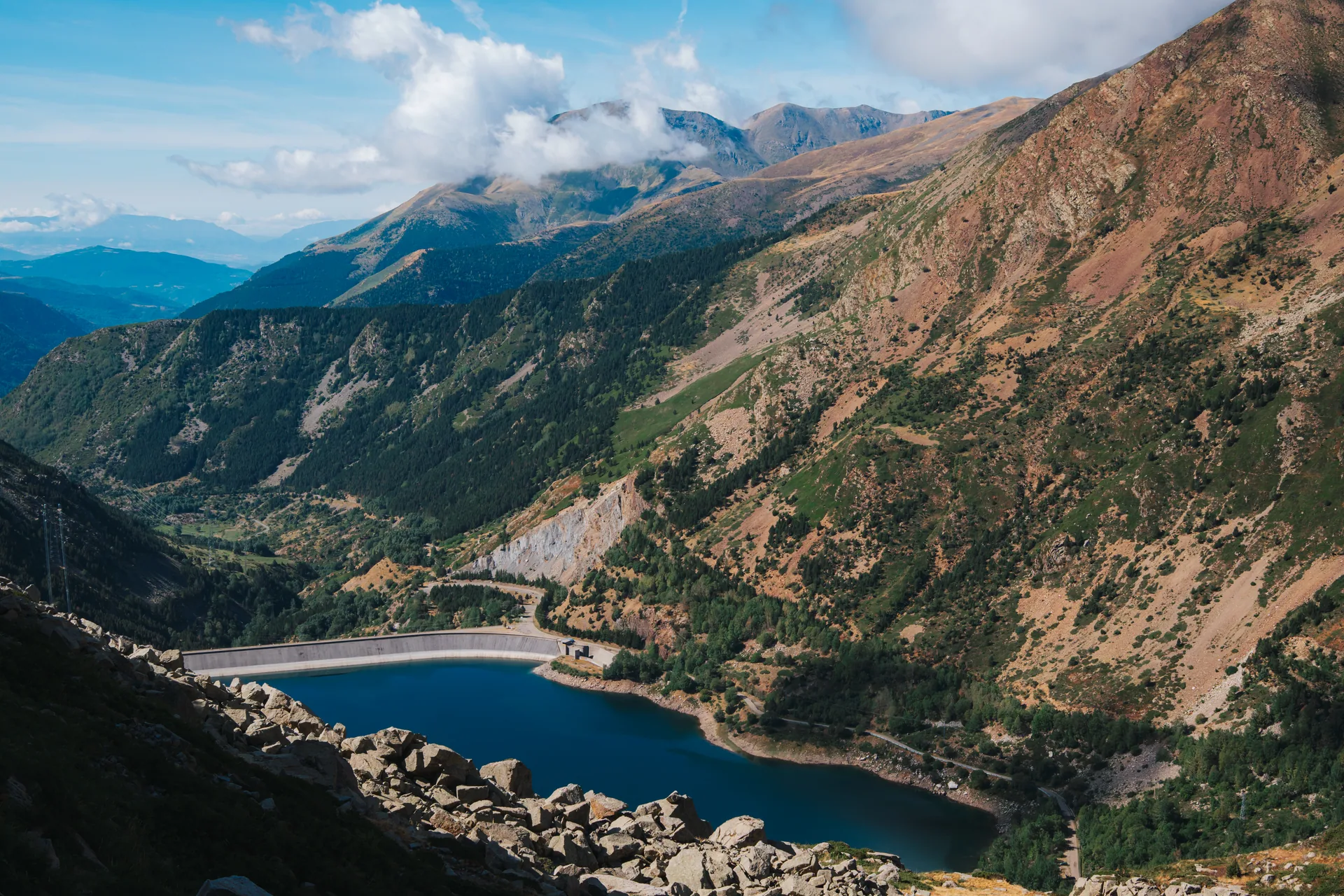
View of Vall Fosca and the Sallente reservoir in Pallars Jussà.
Vall Fosca is one of the most varied valleys in the Lleida Pyrenees.
The road follows the Flamisell River northwards as the landscape gradually changes. The villages become smaller, the slopes close in, forests gain prominence and, at the head of the valley, the rural landscape gives way to genuine high-mountain terrain with glacial lakes and peaks approaching 3,000 metres.
But reducing Vall Fosca to Estany Gento would mean seeing only a small part of it.
Here you will find villages with traditional architecture and Romanesque heritage, old paths linking valleys, a remarkable history connected with hydroelectric power, hiking routes, canyons, trail running and, when the snow arrives, plenty of terrain for snowshoeing and ski touring.
The official tourist network includes 19 settlements and more than 100 km of marked paths and trails.
For MundoCanyon, it is also a particularly interesting area because the activity can be adapted to the group: a family can visit villages or walk along the Carrilet, while an experienced group can plan a long high-mountain route, a canyon descent or a winter outing.
Where Vall Fosca is and why it is worth visiting
Vall Fosca lies in the north of Pallars Jussà, and its main geographical axis is the Flamisell River.
It is accessed from Senterada via the L-503 road, which climbs gradually through the valley until it reaches the Sallente dam.
This layout means that travelling through Vall Fosca is almost like reading the landscape step by step.
At lower elevations there are fields, villages and old agricultural paths. As you move towards Capdella, Sallente and Estany Gento, the slopes become steeper and the environment becomes unmistakably Pyrenean.
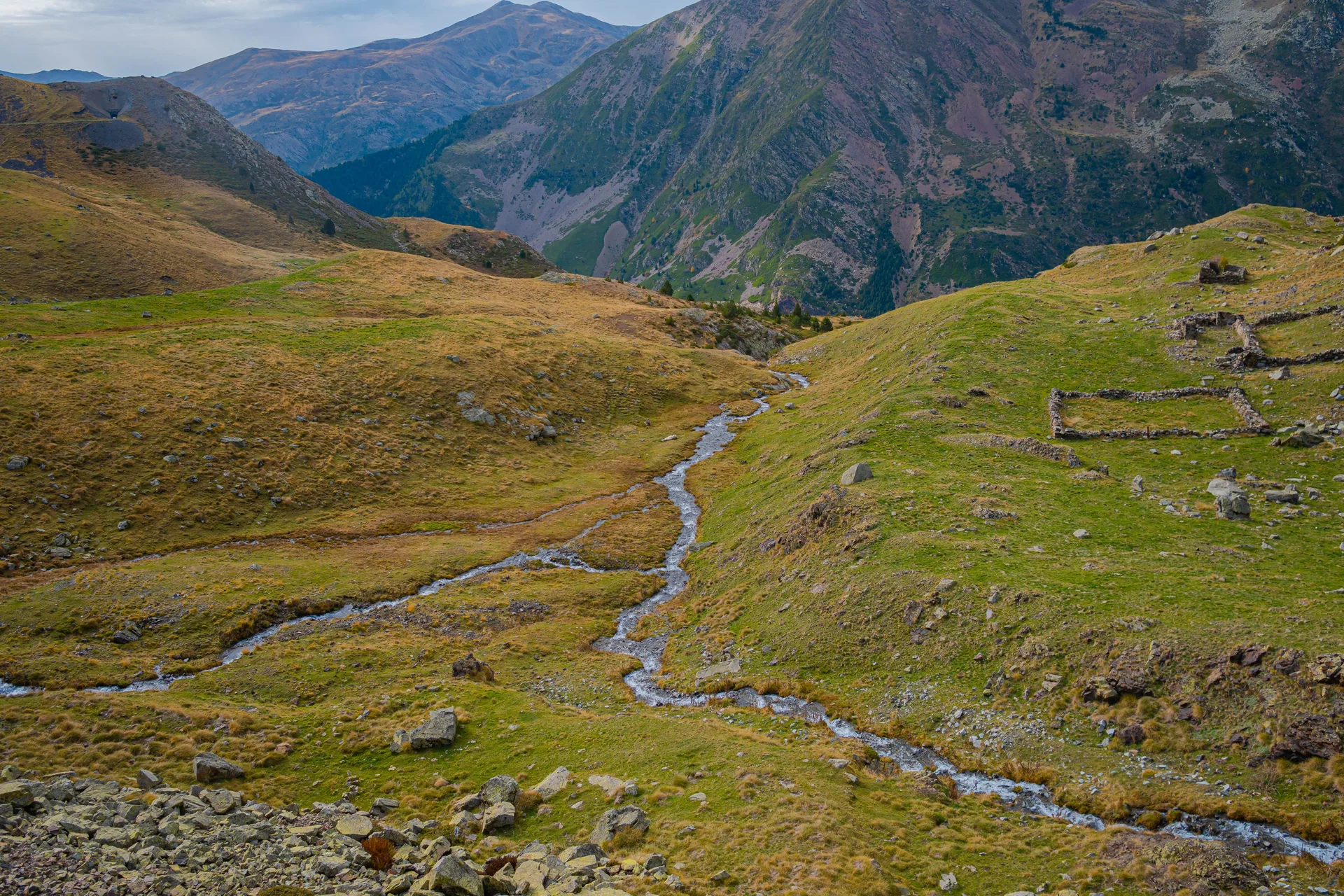
High-mountain landscape in Vall Fosca, Pallars Jussà.
One of its greatest advantages is that there is no single way to discover it.
You can spend a day exploring villages and heritage sites, go up to Estany Gento, plan a full day of hiking, go canyoning or use Vall Fosca as a starting point for entering Aigüestortes i Estany de Sant Maurici National Park.
Would you like to discover Vall Fosca on foot?
At MundoCanyon we can choose the itinerary according to the group’s level, the time of year, mountain conditions and the type of landscape you would like to discover.
The most interesting villages in Vall Fosca
One of the most common mistakes is to drive through Vall Fosca thinking only about reaching Sallente or Estany Gento.
The villages are an essential part of the landscape and help us understand how people lived in this valley before modern roads and the hydroelectric industry completely changed local communications.
Vall Fosca includes settlements such as Capdella, Espui, Estavill, La Pobleta de Bellveí, Aiguabella, Antist, Aguiró, Astell, Mont-ros, Pobellà, Envall and Castell-estaó, among others.
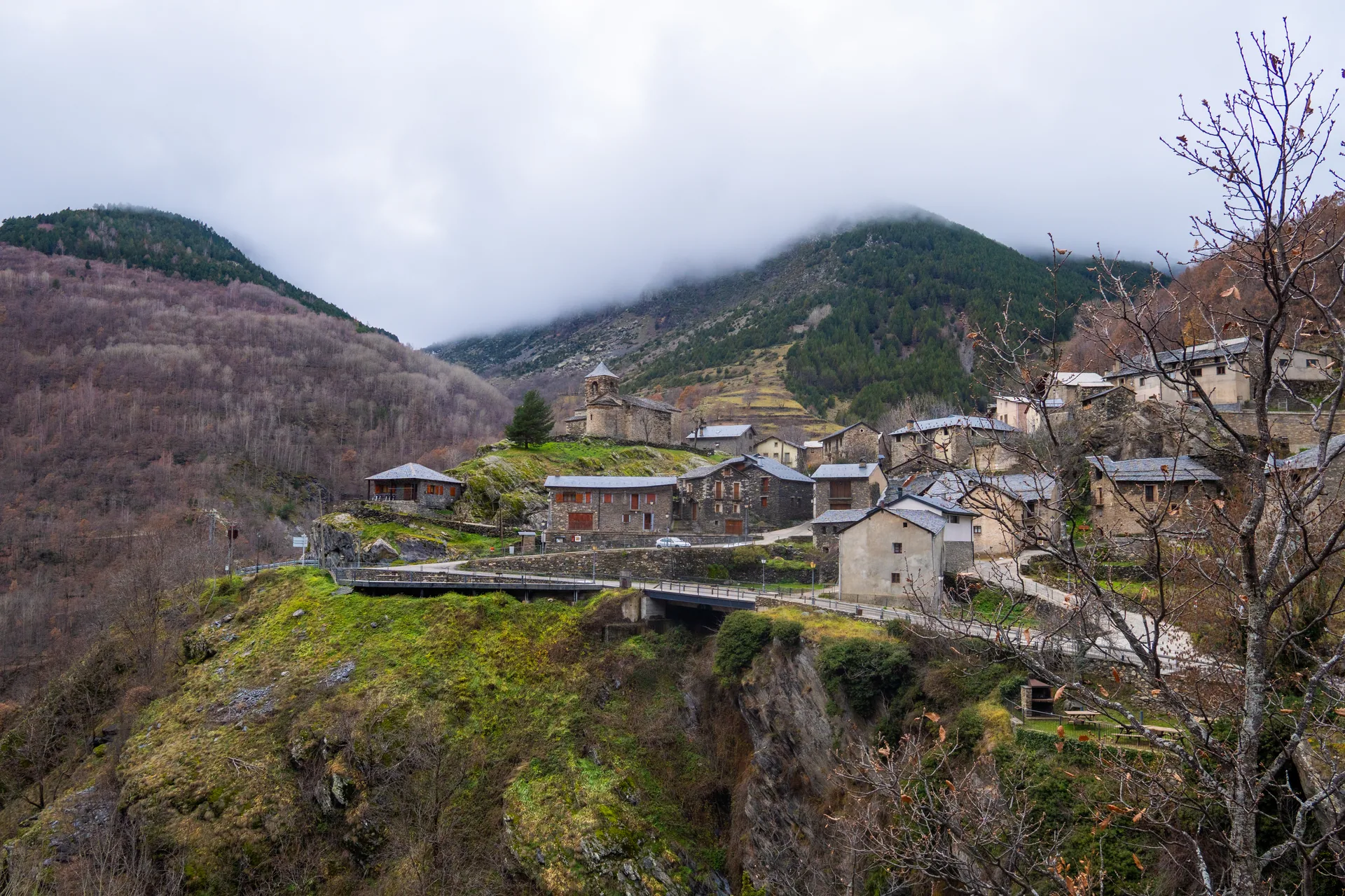
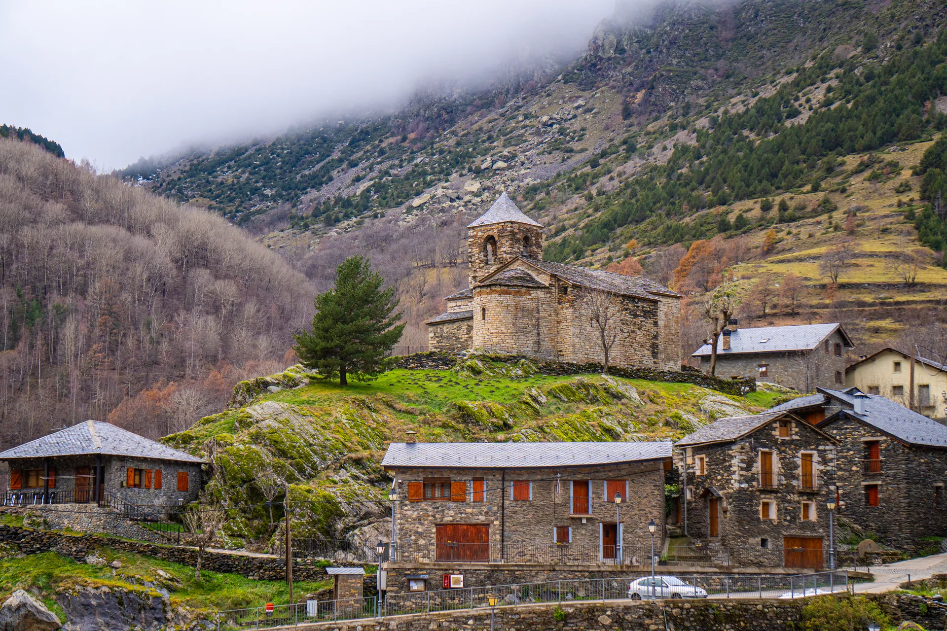
One of the mountain villages of Vall Fosca, in Pallars Jussà.
Capdella
Capdella is one of the essential stops.
Its elevated position already shows that historically the territory did not function only along the bottom of the valley.
Old routes start here towards Sallente, the Riqüerna valley, Port de Rus, the Filià area and the Capdella power station.
Its Romanesque heritage is also worth noticing, forming part of a network of small mountain churches scattered throughout Vall Fosca.
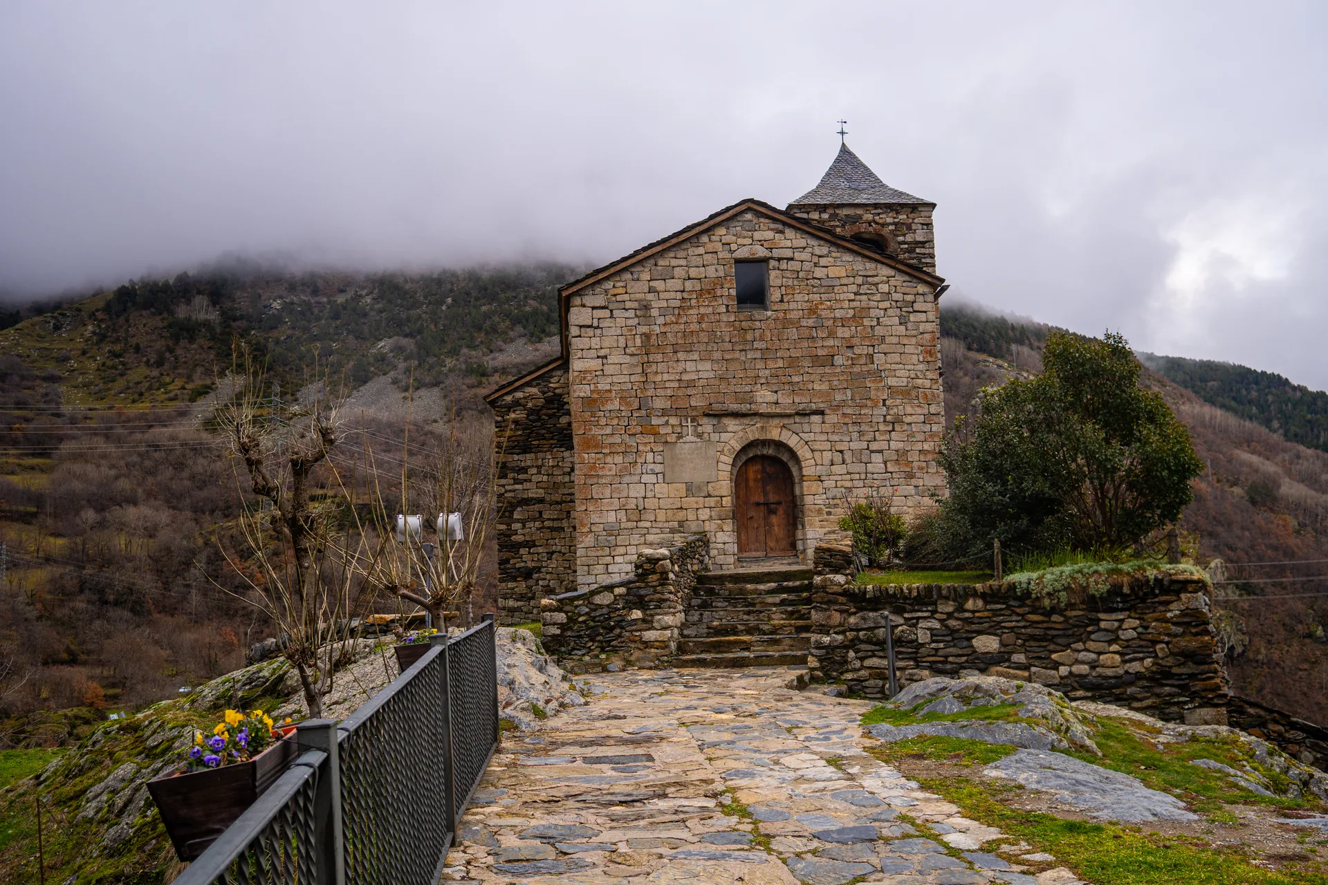
Romanesque heritage in Vall Fosca, in the Lleida Pyrenees.
Capdella is especially interesting if you want your visit to be more than simply “seeing a pretty village” and instead understand its relationship with the paths and surrounding landscape.
Espui
Espui retains a compact mountain-village layout and is another useful starting point for excursions.
From the surrounding area you can head towards Filià and other mountain sectors.
Its location also makes it easy to combine heritage, scenery and physical activity without having to travel all the way to the head of the valley.
Estavill
Estavill is particularly worth stopping at because of the structure of the village itself.
Its layout preserves medieval features and covered passages that help you imagine how these small settlements were organised when protection and efficient use of space were fundamental.
It is also connected to other villages by old paths.
One of the official routes, for example, links La Pobleta de Bellveí with Estavill, allowing you to turn a visit to two villages into a walk.
La Pobleta de Bellveí
La Pobleta de Bellveí lies in the lower part of the valley and is one of its main settlements.
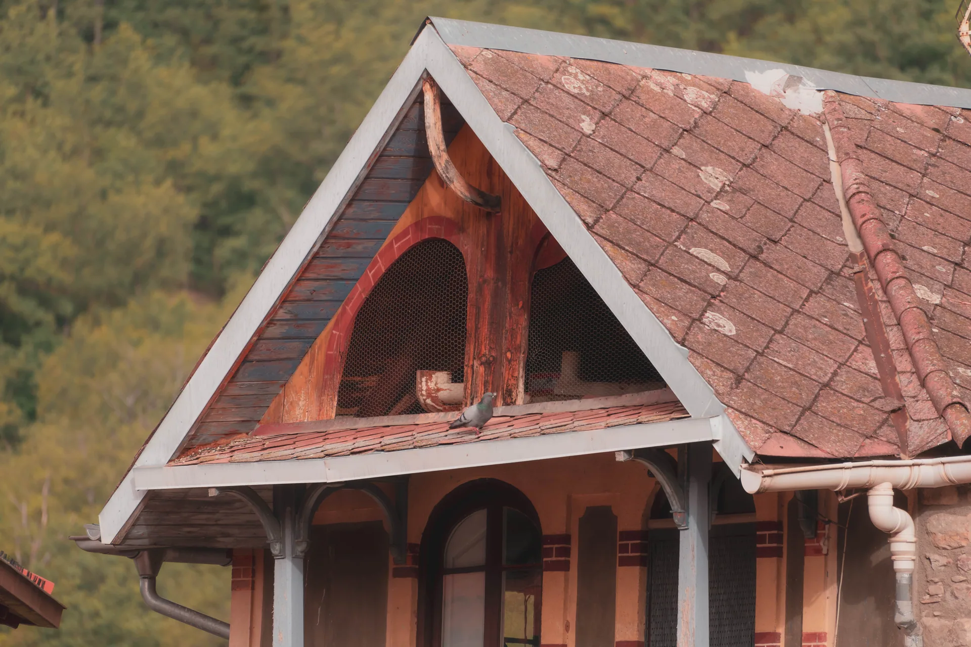
It is also a good place to discover the more rural side of Vall Fosca.
The traditional Fira Ramadera is held here, which we will discuss later, and paths lead towards Estavill, Antist and other nearby places.
Aiguabella
Aiguabella is much smaller and offers a different image: a tiny settlement surrounded by meadows and mountains.
From this area you can follow the route towards the Cambra d’Aigües, part of the official Vall Fosca trail network.
Envall and the villages transformed by depopulation
The history of Pyrenean settlements cannot be separated from the process of rural depopulation.
In some places the population fell to very low levels, while other settlements were partly abandoned or transformed.
It is a phenomenon repeated in many parts of the Pallars.
If this subject interests you, you can read more in our guide to abandoned villages in Catalonia and discover a particularly interesting case in our article about Herba Savina.
Estany Gento: one of the symbols of Vall Fosca
Estany Gento is probably the best-known place in Vall Fosca.
It lies at the head of the valley, at approximately 2,200 metres, and serves as one of the main access points to the lake district of the National Park.
During its operating season, the Vall Fosca cable car connects Sallente with Estany Gento.
The journey takes approximately 14 minutes and gains around 450 metres of elevation. The service is seasonal, usually operating during summer, so it is always worth checking that year’s official dates and timetable before planning your visit.
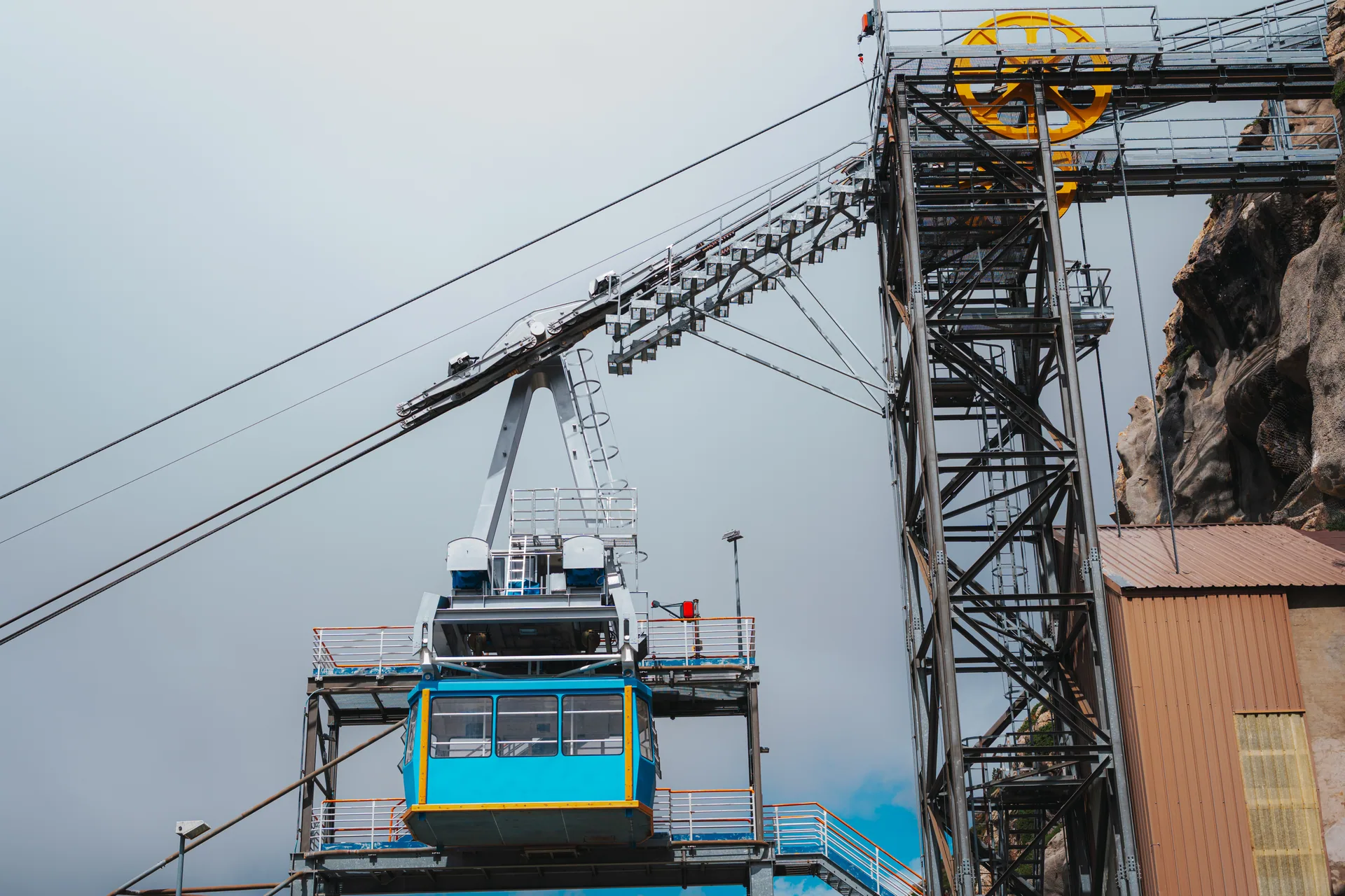
Vall Fosca cable car, connecting the Sallente dam with Estany Gento during the operating season.
But taking the cable car up and immediately coming back down would mean missing one of the most interesting areas of Vall Fosca.
Many possibilities open up from Estany Gento.
You can walk part of the Carrilet, continue towards other lakes, head for the Colomina refuge or plan much longer high-mountain itineraries.
Vall Fosca’s own tourist information highlights that the cable-car area provides access to a landscape with dozens of lakes and routes towards summits such as Montsent de Pallars and Peguera.
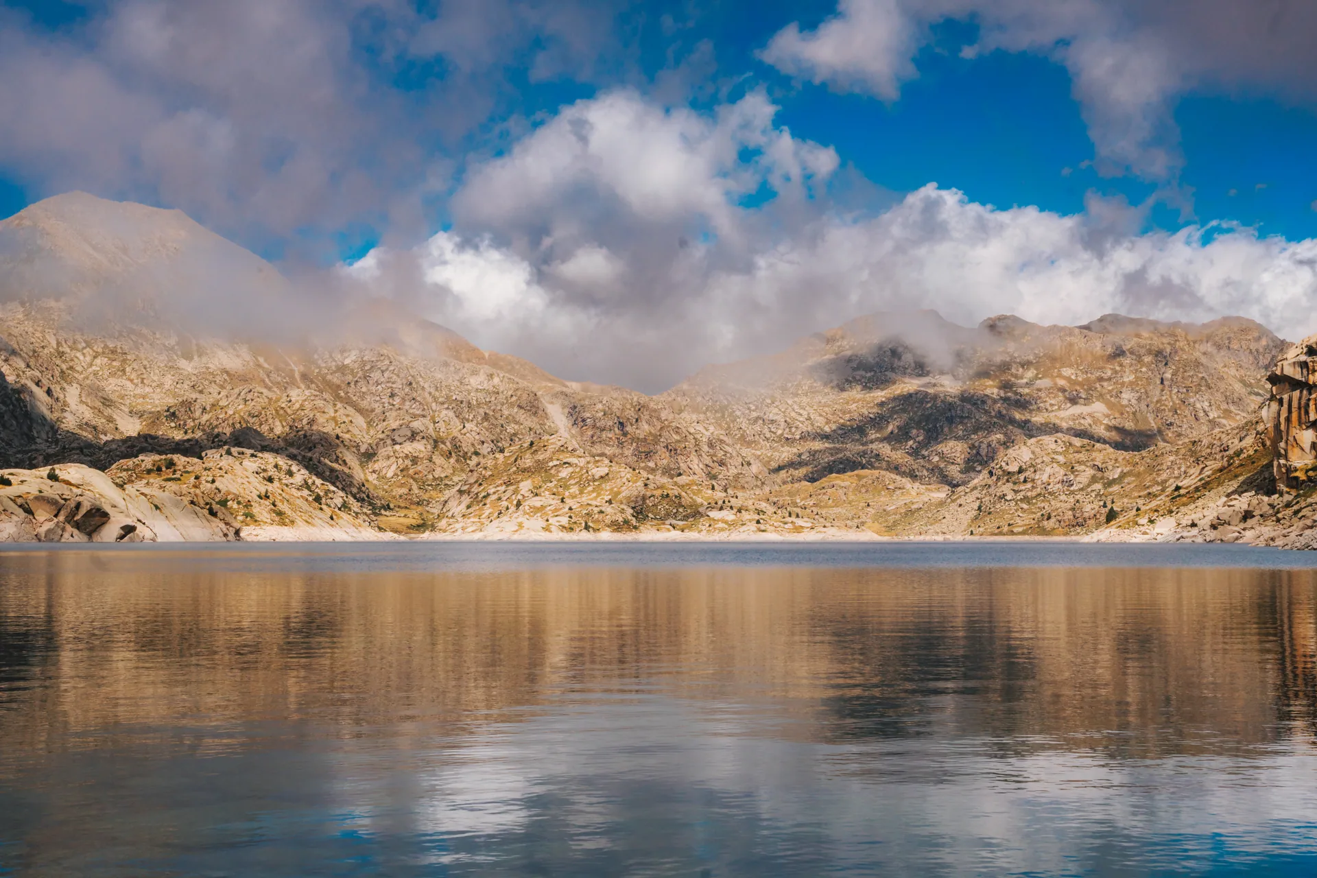
High-mountain lake landscape in Vall Fosca, near Aigüestortes i Estany de Sant Maurici National Park.
Estany Gento and the cold-temperature record
Estany Gento is also connected with one of Spain’s best-known meteorological episodes.
At MundoCanyon we have already dedicated a separate article to the subject, explaining why this place is associated with the historic record for extremely low temperatures:
Estany Gento: the coldest place in Spain →
Vall Fosca as a gateway to Aigüestortes National Park
The head of Vall Fosca is one of the most interesting ways to enter Aigüestortes i Estany de Sant Maurici National Park from Pallars Jussà.
This entrance has a very distinctive character.
Instead of starting directly in a wooded valley, you arrive in a landscape where glacial lakes coexist with dams, water channels and old infrastructure built for electricity production.
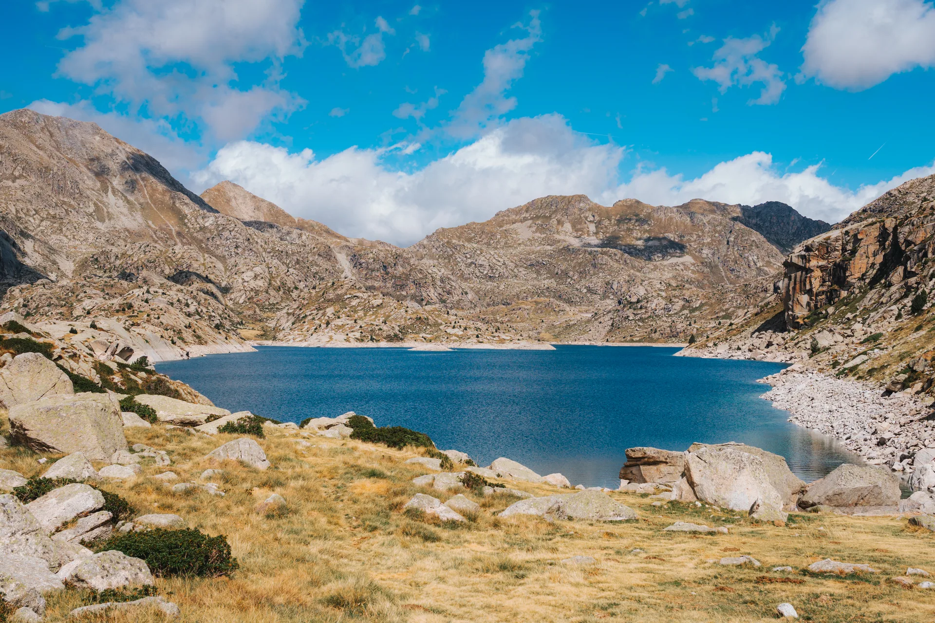
One of Vall Fosca’s high-mountain lakes, near Aigüestortes i Estany de Sant Maurici National Park.
The result is an unusual combination of high-mountain nature and industrial history.
From Estany Gento you can continue towards Estany Tort, Colomina and other lakes in the upper area, connect with mountain refuges and start multi-day traverses.
If you want to learn more about the park, its entrances, lakes and main routes, see our complete guide to Aigüestortes i Estany de Sant Maurici National Park.
Hiking routes in Vall Fosca
One of Vall Fosca’s greatest advantages is that it does not force you to choose between an “easy walk” and “high mountain”.
There are intermediate options and very different routes.
The official network includes paths between villages, old traditional routes, access trails to refuges and itineraries reaching the high areas of the National Park.
At MundoCanyon we can prepare hiking routes in the Pyrenees, selecting the itinerary according to the group’s level, the weather, the season and the aims of the outing.
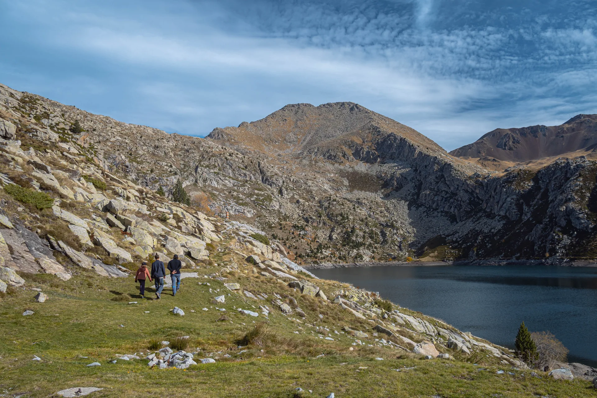
Hiking route beside a high-mountain lake in Vall Fosca.
These are some of the most interesting options in Vall Fosca.
Sallente – Estany Gento via the Canal de Pigolo
If you do not want to use the cable car, you can reach Estany Gento on foot from Sallente.
The official route via the Canal de Pigolo is approximately 3.5–4 km long with 386 metres of ascent.
The path climbs from the dam area until it joins the old Carrilet track and then continues towards Estany Gento.
It is a good choice for anyone who wants Estany Gento to be the true objective of the walk rather than simply the cable-car arrival point.
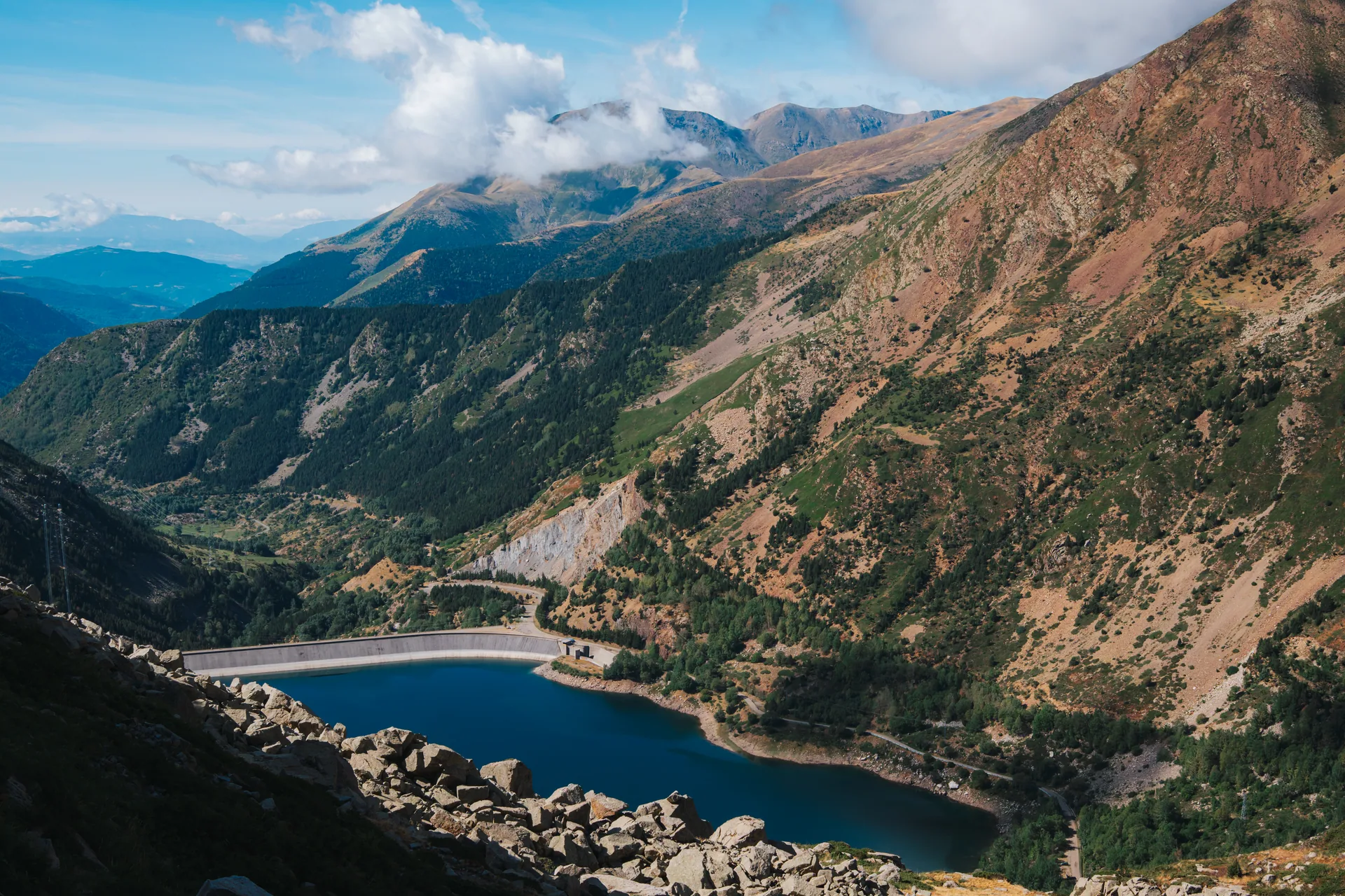
View of the Sallente dam and the mountains of Vall Fosca in Pallars Jussà.
Carrilet Greenway
The Carrilet is probably one of the best-known routes in Vall Fosca.
The official route between Estany Gento and the Cambra d’Aigües covers around 5 km with only about 68 metres of elevation gain, following the former railway infrastructure associated with the hydroelectric works.
That does not mean that every way of accessing the Carrilet automatically makes the excursion easy.
Using the cable car makes the route much more accessible. If you climb from Sallente on foot via Pigolo, the overall effort changes considerably.
This difference is important when planning a route for families or people who are not used to mountain walking.
Estany Gento – Estany Tort – Colomina
Those who want to go a little further can continue from Estany Gento towards Estany Tort and the Colomina refuge.
Here you clearly enter high-mountain terrain.
The route takes you from the relatively busy cable-car area into a landscape of lakes, rock and wide views where the scale of the upper Vall Fosca becomes much clearer.
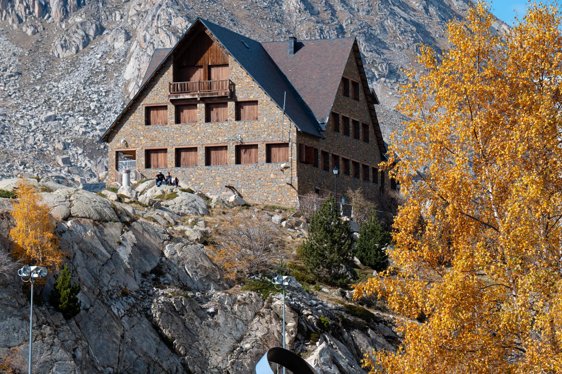
High-mountain refuge in the Vall Fosca area.
From Colomina there are also numerous options for extending the route.
Capdella – Port de Rus
Port de Rus appears among the official Vall Fosca itineraries and represents a different style of hiking.
These mountain passes were historically extremely important because they connected valleys that today are linked mainly by roads.
Walking through them is not only about sport: it also helps you understand how people, livestock and goods moved before the modern road network existed.
Capdella, Riqüerna and Sallente
Paths also lead from Capdella towards the head of the valley and the Riqüerna sector.
The official network includes, among others, the Camí dels Nusars between Capdella and Sallente, as well as other routes in the area.
Depending on the season and the group’s level, these connections can be used to create linear routes or longer combinations.
Filià
Filià is another of Vall Fosca’s major mountain areas.
In summer it offers plenty of possibilities for walking, while in winter it becomes one of the areas with the greatest potential for snow activities.
The area can be linked with different itineraries, and the official network includes both summer routes and winter approaches and traverses through this sector.
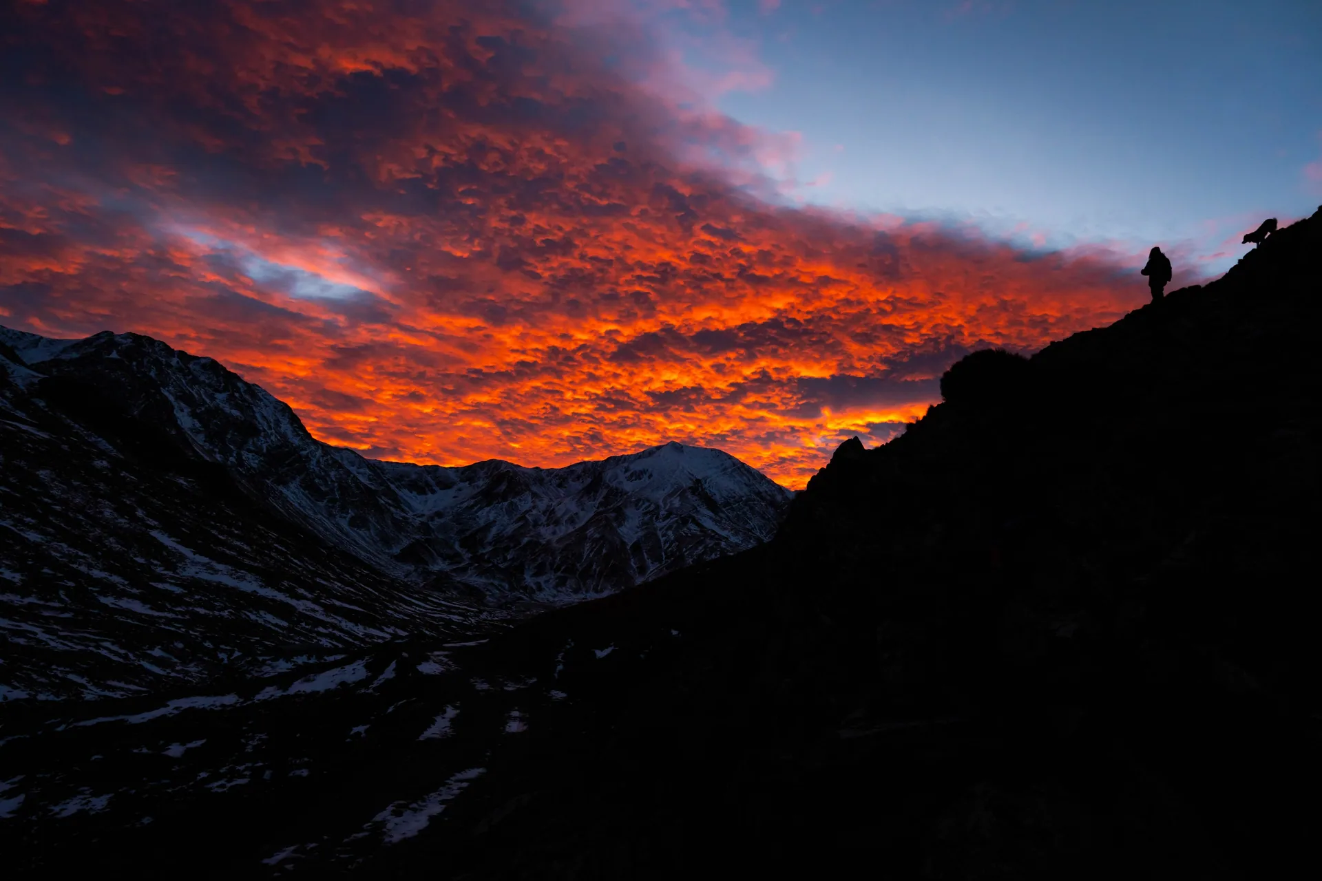
Sunset in Filià, one of the mountain sectors of Vall Fosca.
Routes between villages
Not every route has to involve high mountain.
Official options include routes such as:
- La Pobleta – Estavill;
- La Pobleta – Antist;
- Obeix – Castell-estaó – Antist;
- La Plana de Mont-ros – Paüls – Pobellà – Mont-ros;
- Mont-ros – La Torre de Capdella;
- Estavill – Antist;
- Aguiró – Coll d’Oli.
These are particularly interesting in spring and autumn or whenever you do not want to enter high-mountain terrain.
They also make it easier to understand the old network of communication routes between the villages.
Not sure which Vall Fosca route to choose?
We do not work only with one fixed itinerary. We can choose a walk between villages, a route to Estany Gento or a high-mountain itinerary according to your experience, available time and the conditions on the day.
Snowshoeing in Vall Fosca
In winter, Vall Fosca’s geography remains the same, but the way you move through it changes completely.
Paths disappear beneath the snow, slopes that barely attract attention in summer become more significant, and choosing an itinerary depends far more on the weather and the stability of the snowpack.
Vall Fosca has a wide official selection of winter routes for ski touring and snowshoeing.
These include Filià, Estanys de Francí, Vall de Riqüerna, Colomina, Montsent de Pallars, Font Blanca, Montorroio and other sectors.
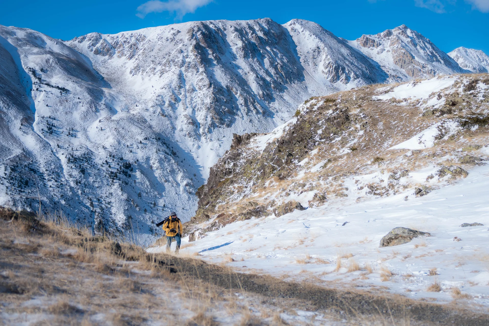
Winter scenery in Vall Fosca, an excellent area for mountain routes and snowshoeing when conditions are suitable.
Snowshoeing in Filià
Filià is one of the first areas we consider when looking for a winter outing in this sector.
Its terrain allows us to prepare routes of different lengths and levels of difficulty.
For beginners, we can look for a moderate itinerary in the lower area. With more experience and good conditions, the terrain allows for more ambitious objectives.
But one thing is important: a good snowshoe route cannot be chosen simply by looking at a map.
Snow conditions, temperatures in the previous days, wind and avalanche risk can make a route that was suitable one week inappropriate just a few days later.
That is why we prefer to choose the itinerary once we know the actual conditions.
Riqüerna
Vall de Riqüerna is another area included among the official winter itineraries.
The atmosphere is different from Filià and allows you to move progressively into a more enclosed mountain landscape before reaching the higher sectors.
Colomina and the lakes
The upper Colomina area offers spectacular winter scenery, but this is already a much more serious mountain environment.
Snow completely changes access and the way the terrain has to be interpreted.
It should not be treated simply as a winter version of a summer route.
Font Blanca from Estany Gento
Among the itineraries published by Vall Fosca is a Font Blanca loop from Estany Gento of around 4.7 km and +485 m, suitable for snowshoes and users with limited mountain experience when access to the starting point is possible.
It is a good example of why the same area can offer very different routes depending on conditions.
At MundoCanyon we organise snowshoe excursions in Catalonia and the Pyrenees and choose the route according to the weather, snow conditions and the group’s level.
If you want to compare different areas before deciding, see our guide to the best snowshoe routes in the Pyrenees.
Canyoning in Vall Fosca
If there is one element that defines Vall Fosca, it is water.
The Flamisell collects water from the upper valley, while numerous canyons descend along its slopes.
That is why, alongside hiking, canyoning in Vall Fosca is one of the activities that best allows you to enter directly into the valley’s terrain.
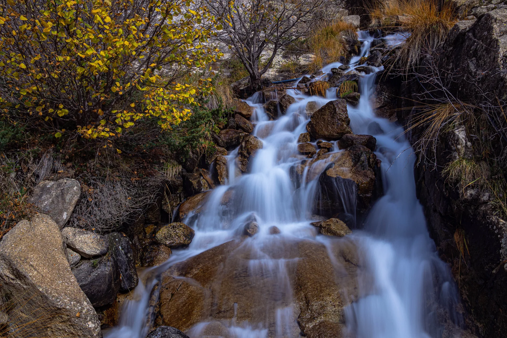
Mountain stream in Vall Fosca, one of the characteristic elements of this valley in Pallars Jussà.
The local area offers different descents and difficulty levels, and MundoCanyon has a dedicated page for the canyons of Vall Fosca.
The descent is chosen according to the group’s experience, the season and, above all, water levels.
Les Espones
Les Espones is one of the descents we can do in the area.
It offers a completely different landscape from the hiking trails: rock, water and progression directly along the watercourse.
Flamisell
The river that geographically structures Vall Fosca is also part of its canyoning offer.
It is a good example of how water is not simply a landscape feature, but the force that has shaped and conditioned the whole valley.
Roi
Roi is another possibility for canyoning in this area.
As with every canyon, conditions must be checked before entering and the itinerary must be suitable for the group’s actual level.
If you want to widen your search to the whole region, see our guide to the best canyons in Pallars Jussà.
The energy that transformed Vall Fosca
One thing clearly distinguishes Vall Fosca from many other Pyrenean valleys: its hydroelectric history.
During the 20th century, the valley’s lakes, rivers and major elevation differences began to be used for electricity production.
That transformation left infrastructure that is now part of the landscape.
Canals, dams, pipes, buildings, reservoirs and old railway tracks appear alongside trails and lakes.
The Carrilet, now one of Vall Fosca’s best-known hiking routes, was created precisely in this context.
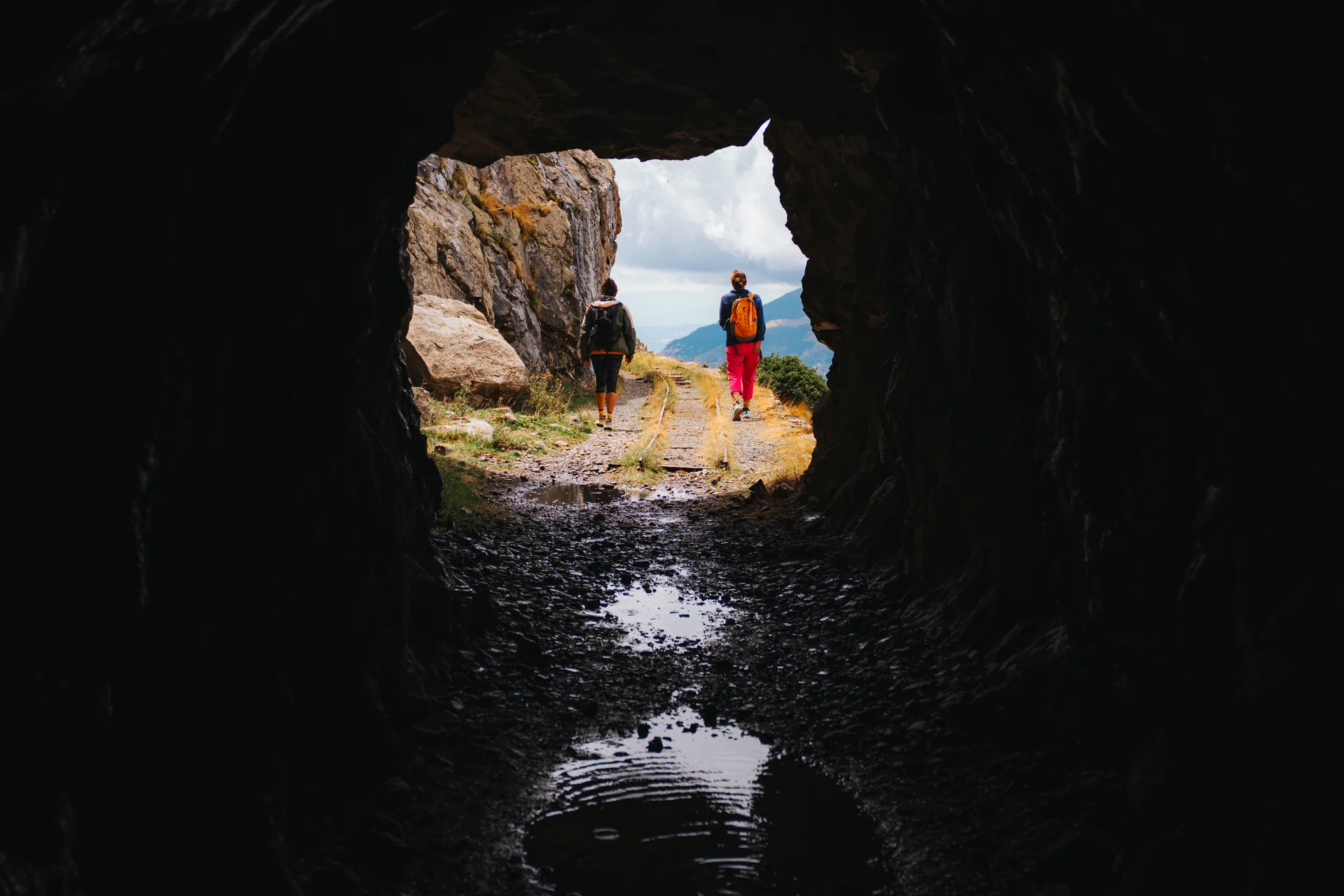
The former Vall Fosca Carrilet railway, now one of the area’s best-known walking routes.
To understand this history better, it is worth visiting the Capdella Hydroelectric Museum.
Here, the history of energy is not separate from the landscape.
It explains why certain structures are found above 2,000 metres and why there is a cable car capable of quickly overcoming the elevation difference between Sallente and Estany Gento.
Fairs, trail running and mountain events in Vall Fosca
Vall Fosca is not only a destination to explore independently.
Throughout the year, sporting activities, hiking events and traditional gatherings offer another way to discover the valley.
La Cabanera: trail running on the paths of Vall Fosca
For mountain runners, La Cabanera is one of Vall Fosca’s benchmark events.
One of the most interesting ideas behind the race is the use of the mountain-path network to showcase different parts of the valley.
Vall Fosca also promotes trail running as a characteristic local activity, making use of its more than 100 km of trails and the great variety of elevation profiles and landscapes.
That means its appeal is not limited to race day.
The paths used for competitions and training make it possible to design very different trail-running outings, from routes between villages to demanding days with substantial elevation gain.
For regular mountain runners, Vall Fosca has one major advantage: over relatively short distances you can move from lower elevations into genuine high-mountain terrain.
Vall Fosca – Pyrenees Hiking Festival
The Vall Fosca – Pyrenees Hiking Festival offers another way to discover the area.
It is not focused only on walking, but on interpreting what you see.
Its 2026 edition, held from 9 to 12 July, included activities related to geology, Estany Gento and the Carrilet, astronomy, heritage, climate change and guided routes around the National Park.
This is exactly the philosophy we find most interesting in the mountains: moving through a landscape while understanding why it has that shape, how it was used in the past and the relationship between nature and human activity.
Fira Ramadera de la Pobleta de Bellveí
To discover Vall Fosca’s more rural side, you also have to look towards La Pobleta de Bellveí.
Its Fira Ramadera is one of the valley’s traditional events and maintains its connection with Pyrenean livestock farming.
Programmes have included livestock exhibitions and competitions, breeds such as Bruna dels Pirineus cattle and Xisqueta sheep, traditional crafts, artisan producers, family activities, food and music.
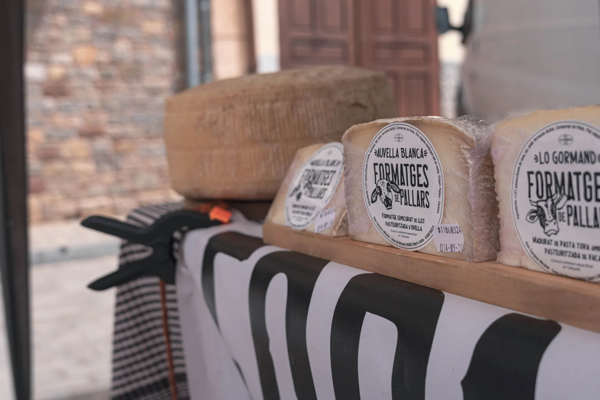
Artisan cheeses from the Pallars at one of the stalls of the Fira Ramadera in La Pobleta de Bellveí.
It is a particularly interesting visit because it reminds us of something that is sometimes forgotten when the Pyrenees are seen only as a leisure destination: these landscapes are also working territories.
Meadows, barns, paths and villages were not created to form part of a tourist route. They are the result of centuries of farming, livestock breeding and forestry.
When are these events held?
The exact dates can change every year.
The Hiking Festival is normally held during the summer season, while the Fira Ramadera takes place in autumn.
La Cabanera and other sporting events may also change their dates, formats and courses from one edition to another.
So if you want your trip to coincide with a particular event, we recommend checking the official calendar before booking.
Other activities in Vall Fosca and the Pallars
Vall Fosca works very well as part of a multi-day trip because you do not have to repeat the same type of activity every day.
You can combine a day of hiking with canyoning and keep another day for discovering a completely different part of the Pallars.
Via ferratas
If you want to add a vertical activity to your stay, there are equipped routes of different levels in the Pallars and other nearby areas of the Pyrenees.
See our via ferratas in the Pyrenees.
Caving
Another option is to go literally from the high mountains into the underground world.
Caves reveal another part of the geology of this area and offer a completely different activity from hiking or canyoning.
See our caving activities in Catalonia.
Orienteering activity
The mountains can also become a playing field.
During our orienteering activity in the Pyrenees, participants learn the basics of map and compass use and then have to find checkpoints while making their own decisions on the terrain.
It is particularly suitable for families, groups of friends, schools and companies looking for an outdoor team-building activity.
The best time to visit Vall Fosca
There is no single best season.
Vall Fosca changes significantly throughout the year, and the right time depends on what you want to do.
Spring
Spring transforms the lower and middle elevations first.
Forests turn green again, water becomes more prominent and temperatures are pleasant for walking between villages.
Higher elevations, however, may still have fully winter conditions.
It is important not to use the calendar as the only reference: May may feel like spring in La Pobleta while still looking like winter at higher elevations.
Summer
This is the easiest season for discovering Estany Gento, the Carrilet and the upper areas.
The cable car operates seasonally during summer and makes access to Estany Gento much easier.
It is also the season with the greatest number of possibilities for long hiking routes.
But summer does not eliminate high-mountain risks. Above 2,000 metres, a storm or sudden fall in temperature can change conditions quickly.
Autumn
For routes through forests, villages and middle elevations, autumn is one of our favourite seasons.
Temperatures are more pleasant and the colour of the landscape changes completely.
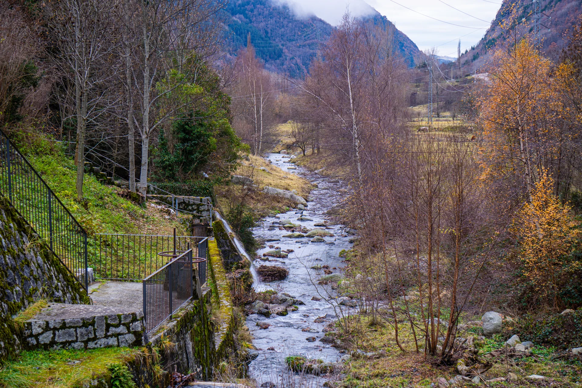
Autumn scenery beside the river in Vall Fosca, in the Lleida Pyrenees.
It is also a good season for combining Vall Fosca with other parts of the Pallars.
For example, you can head towards Boumort, where autumn coincides with one of the most interesting periods for wildlife observation.
Learn more about the area in our complete guide to the Boumort Reserve.
Winter
When the snow arrives, many summer routes stop being simple hiking itineraries.
Navigation, equipment and terrain assessment all change.
In return, one of the most interesting seasons for discovering Vall Fosca begins: snowshoeing.
Filià and other sectors make it possible to prepare very different itineraries, from beginner routes to outings for people accustomed to moving through winter mountain terrain.
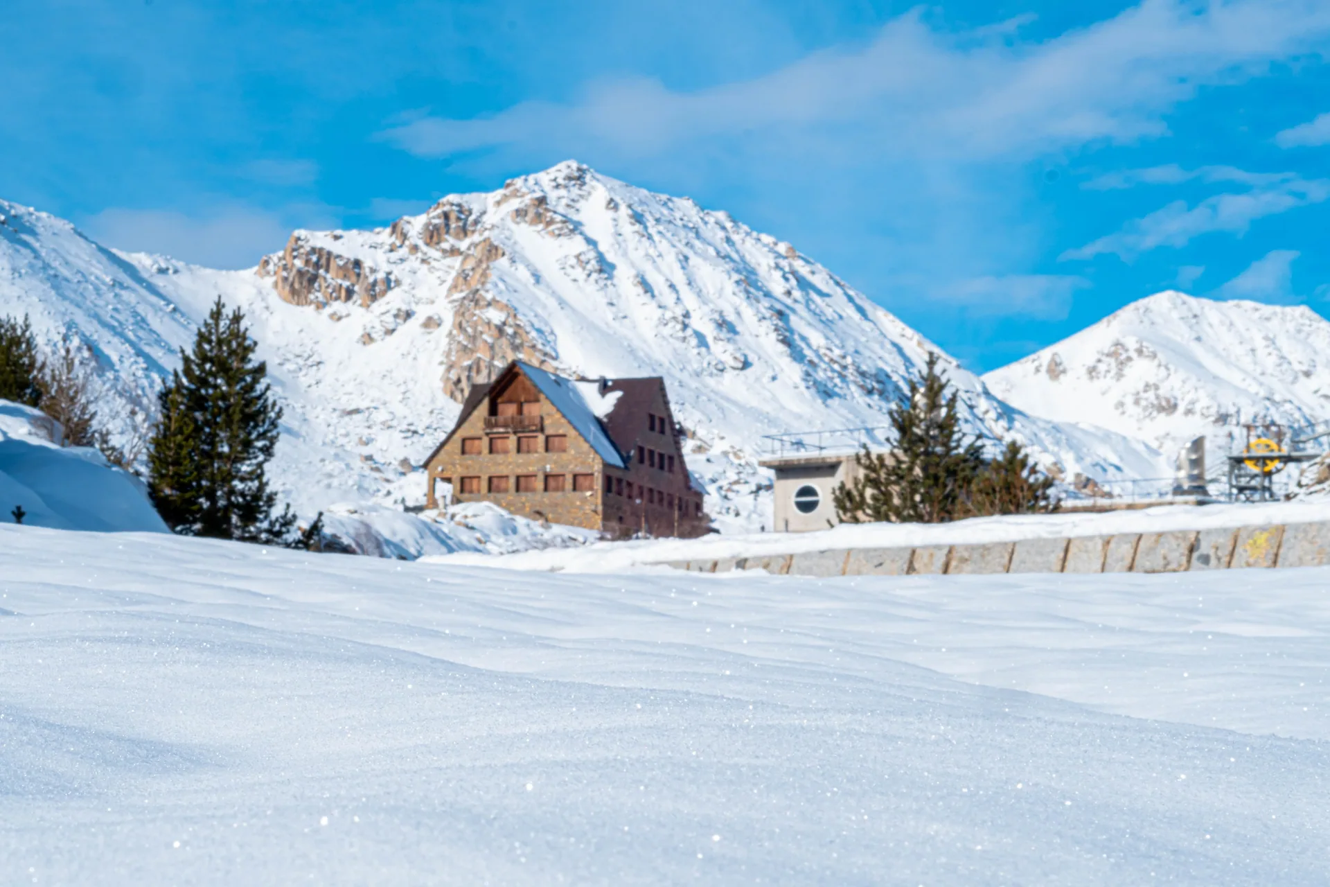
Winter landscape in the upper Vall Fosca, in the Lleida Pyrenees.
How many days to spend in Vall Fosca
You can drive through the valley and visit Estany Gento in one day.
But truly getting to know Vall Fosca requires more time.
Vall Fosca in one day
If you only have one day, we would choose one main objective.
For example:
- visit a few villages;
- continue towards Capdella and Sallente;
- take the cable car to Estany Gento if it is operating;
- and walk part of the Carrilet.
Trying to add a canyon or a long route as well would turn the day into more of a race than a visit.
Vall Fosca in two days
With two days, you can already combine two different sides of the valley.
Day 1:
- villages and heritage;
- Capdella;
- Sallente;
- Estany Gento and the Carrilet.
Day 2:
- a hiking route;
- or canyoning in Vall Fosca.
Vall Fosca in three days
With three days, you can plan a much more complete stay:
- one day for Estany Gento and high mountain;
- one day of canyoning;
- and one day for villages, heritage or a second route.
In winter, summer routes can be replaced by a snowshoe outing.
Four days or more
With more time, it is worth extending the trip to the rest of the Pallars.
Vall Fosca can be combined with Boumort, Collegats, La Pobla de Segur, other sectors of Aigüestortes, abandoned villages, via ferratas or caves.
Are you spending several days in the Pallars?
We can combine hiking, canyoning, snowshoeing and other activities into a programme adapted to the season, conditions and the group’s level.
What to see near Vall Fosca
One of Vall Fosca’s greatest advantages is its location within the Pallars.
There is no need to treat it as an isolated destination.
La Pobla de Segur
La Pobla de Segur is an excellent connection point between different parts of the Pallars.
From there you can easily reach Vall Fosca, Collegats, Boumort and other areas.
If you are spending several days in the region, see our guide to what to do in La Pobla de Segur.
Boumort Reserve
Boumort offers a completely different landscape.
Instead of the lake-filled high mountain at the head of Vall Fosca, you will find a Pre-Pyrenean landscape of forests, large limestone formations and an exceptional presence of wildlife.
See our Boumort Reserve guide to discover its routes and main points of interest.
Other parts of Aigüestortes
Entering the National Park from Vall Fosca allows you to discover one of its sides.
But Aigüestortes is much larger.
If you have time, it is worth exploring other entrances and comparing landscapes.
Our guide to Aigüestortes i Estany de Sant Maurici National Park will help you choose.
Abandoned villages of the Pallars
If you are particularly interested in the human history of these mountains during your visit, you can continue exploring old rural settlements.
Our guide to abandoned villages in Catalonia brings together different examples from the Pallars and other parts of Lleida.
You can also discover the story of Herba Savina, one of the most interesting abandoned settlements around Boumort.
Frequently asked questions about Vall Fosca
Where is Vall Fosca?
Vall Fosca lies in the north of Pallars Jussà, in the Lleida Pyrenees. Its main access road is the L-503 from Senterada, which climbs through the valley following roughly the course of the Flamisell River as far as Sallente.
What should you see in Vall Fosca?
Some of the most interesting places are Estany Gento, the Sallente dam, the Carrilet greenway, Capdella, Estavill, Espui, La Pobleta de Bellveí, the hydroelectric heritage and the high-mountain area linked to Aigüestortes i Estany de Sant Maurici National Park.
Which is the prettiest village in Vall Fosca?
It depends on what you are looking for. Capdella stands out for its location and historic links with the mountains; Estavill for its distinctive urban structure; Espui for its location and access to routes; and La Pobleta de Bellveí for its rural atmosphere and traditional livestock fair.
How do you get to Estany Gento?
During the operating season, you can take the Vall Fosca cable car from Sallente. You can also walk from the Sallente dam via the Canal de Pigolo, following a route of approximately 3.5–4 km with 386 metres of ascent to Estany Gento.
When does the Vall Fosca cable car operate?
The cable car operates seasonally, mainly during summer. Dates and timetables may change, so it is always worth checking the official Vall Fosca information before planning your trip.
Are there easy hiking routes in Vall Fosca?
Yes. There are paths between villages and low-elevation-gain routes such as the Carrilet greenway. However, you also need to consider how you reach the start: taking the cable car or climbing on foot can significantly change the overall difficulty.
Can you go canyoning in Vall Fosca?
Yes. Vall Fosca has several canyon descents. MundoCanyon organises canyoning activities in the area and chooses the descent according to participants’ level, the season and water levels.
Where can you go snowshoeing in Vall Fosca?
Filià is one of the areas with the greatest number of possibilities, but there are also winter itineraries in Riqüerna, Estanys de Francí, Colomina, Font Blanca and other sectors. The specific route should always be chosen according to snow conditions and avalanche risk.
What is La Cabanera?
La Cabanera is a trail-running event linked to Vall Fosca that uses different paths and areas of the valley. It is one of the area’s main mountain-sport events and highlights the extensive local trail network.
What events are held in Vall Fosca?
The best known include La Cabanera, the Vall Fosca – Pyrenees Hiking Festival and the traditional Fira Ramadera in La Pobleta de Bellveí. Dates and programmes change every year.
Can you visit Vall Fosca in winter?
Yes. Villages and lower elevations may remain accessible, while the upper areas develop full winter conditions. It is a particularly interesting season for snowshoeing and ski touring, provided the weather and snowpack are properly assessed.
How many days do you need to discover Vall Fosca?
In one day you can see some of the main sights, but we recommend two or three days if you want to combine villages, Estany Gento, hiking and an activity such as canyoning. With four days or more, you can extend your trip to other areas of the Pallars.